MyTopo
Laketon Texas US Topo Map
Couldn't load pickup availability
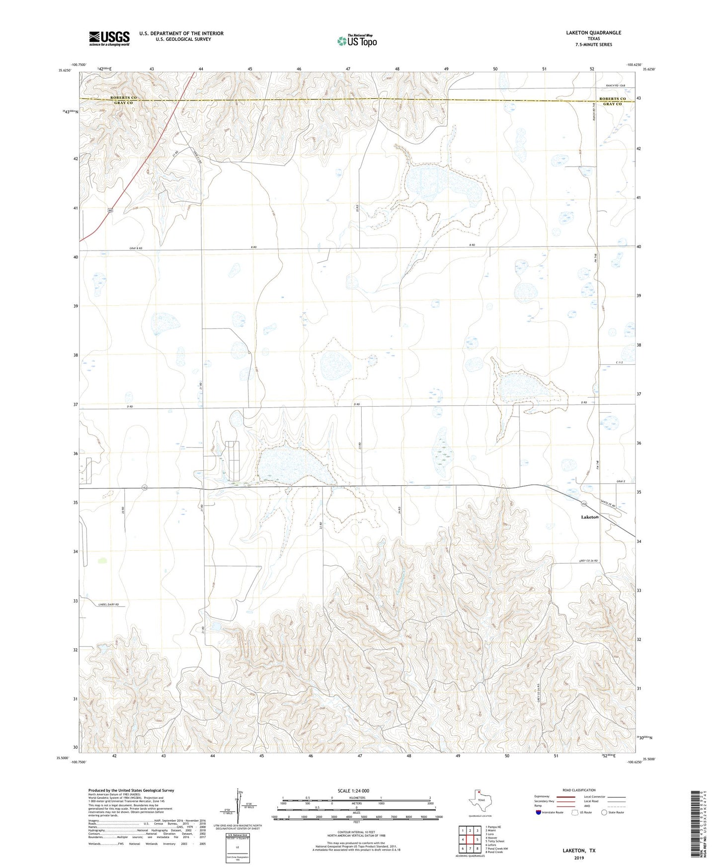
2022 topographic map quadrangle Laketon in the state of Texas. Scale: 1:24000. Based on the newly updated USGS 7.5' US Topo map series, this map is in the following counties: Gray, Roberts. The map contains contour data, water features, and other items you are used to seeing on USGS maps, but also has updated roads and other features. This is the next generation of topographic maps. Printed on high-quality waterproof paper with UV fade-resistant inks.
Quads adjacent to this one:
West: Hoover
Northwest: Pampa NE
North: Miami
Northeast: Lora
East: Totty School
Southeast: Pond Creek
South: Pond Creek NW
Southwest: Lefors
This map covers the same area as the classic USGS quad with code o35100e6.
Contains the following named places: Laketon, Locke Brothers Ranch Lake, Locke Brothers Ranch Lake Dam