MyTopo
Twin Mott Lake Texas US Topo Map
Couldn't load pickup availability
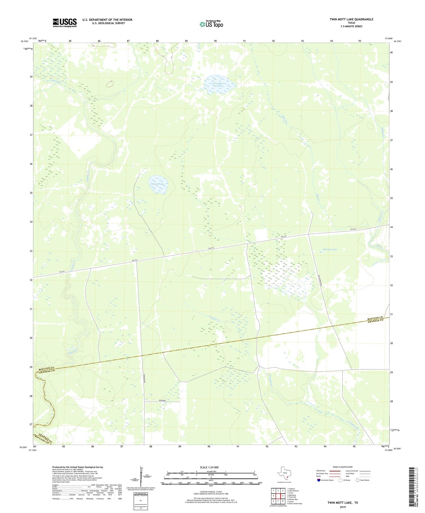
2022 topographic map quadrangle Twin Mott Lake in the state of Texas. Scale: 1:24000. Based on the newly updated USGS 7.5' US Topo map series, this map is in the following counties: Refugio, Aransas. The map contains contour data, water features, and other items you are used to seeing on USGS maps, but also has updated roads and other features. This is the next generation of topographic maps. Printed on high-quality waterproof paper with UV fade-resistant inks.
Quads adjacent to this one:
West: Quintana
Northwest: Vidaurri
North: Lake Pasture
Northeast: Tivoli
East: Tivoli SW
Southeast: Saint Charles Bay
South: Lamar
Southwest: Mission Bay
This map covers the same area as the classic USGS quad with code o28097c1.
Contains the following named places: Alameda Creek, Austwell-Tivoli Division, Cavasso Pens, Chiltipin Well, CIG 804 Heliport, Copano Artesian Well, McGrew Well, Thomas Lake, Twin Mott Lake, Upton Corner Well, Willow Creek, Zapata Lake