MyTopo
Loma Alta Texas US Topo Map
Couldn't load pickup availability
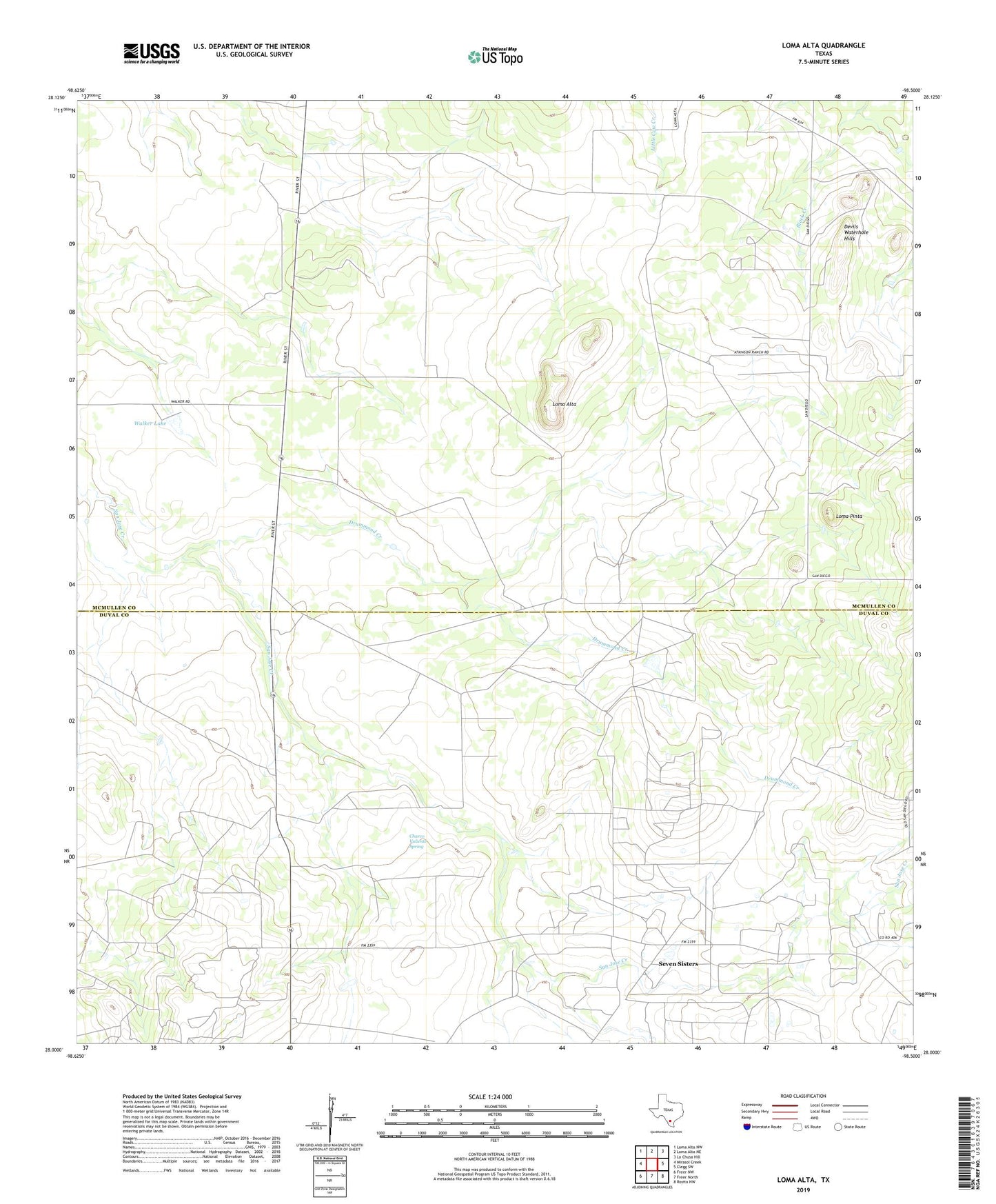
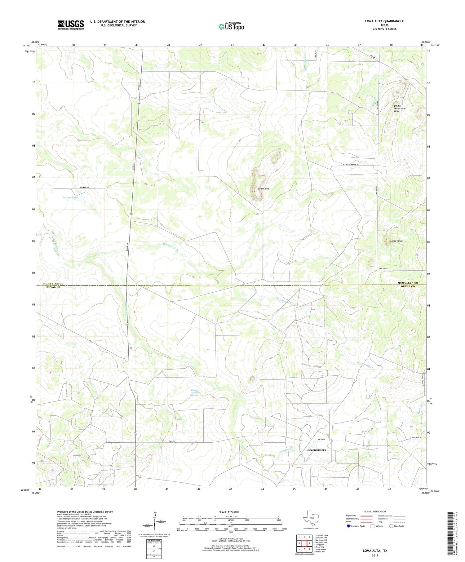
2019 topographic map quadrangle Loma Alta in the state of Texas. Scale: 1:24000. Based on the newly updated USGS 7.5' US Topo map series, this map is in the following counties: McMullen, Duval. The map contains contour data, water features, and other items you are used to seeing on USGS maps, but also has updated roads and other features. This is the next generation of topographic maps. Printed on high-quality waterproof paper with UV fade-resistant inks.
Quads adjacent to this one:
West: Mirasol Creek
Northwest: Loma Alta NW
North: Loma Alta NE
Northeast: La Chusa Hill
East: Clegg SW
Southeast: Rosita NW
South: Freer North
Southwest: Freer NW
Contains the following named places: Charco Valiente Spring, Cody Branch Library, Drummond Creek, Eagle Hill Oil Field, Foster Ranch, Hagist Ranch, Hagist Ranch Gas Plant, Hagist Ranch Oil Field, Loma Alta, Loma Pinta, Seven Sisters, Seven Sisters Oil Field, Walker Lake, Walker Lake Dam