MyTopo
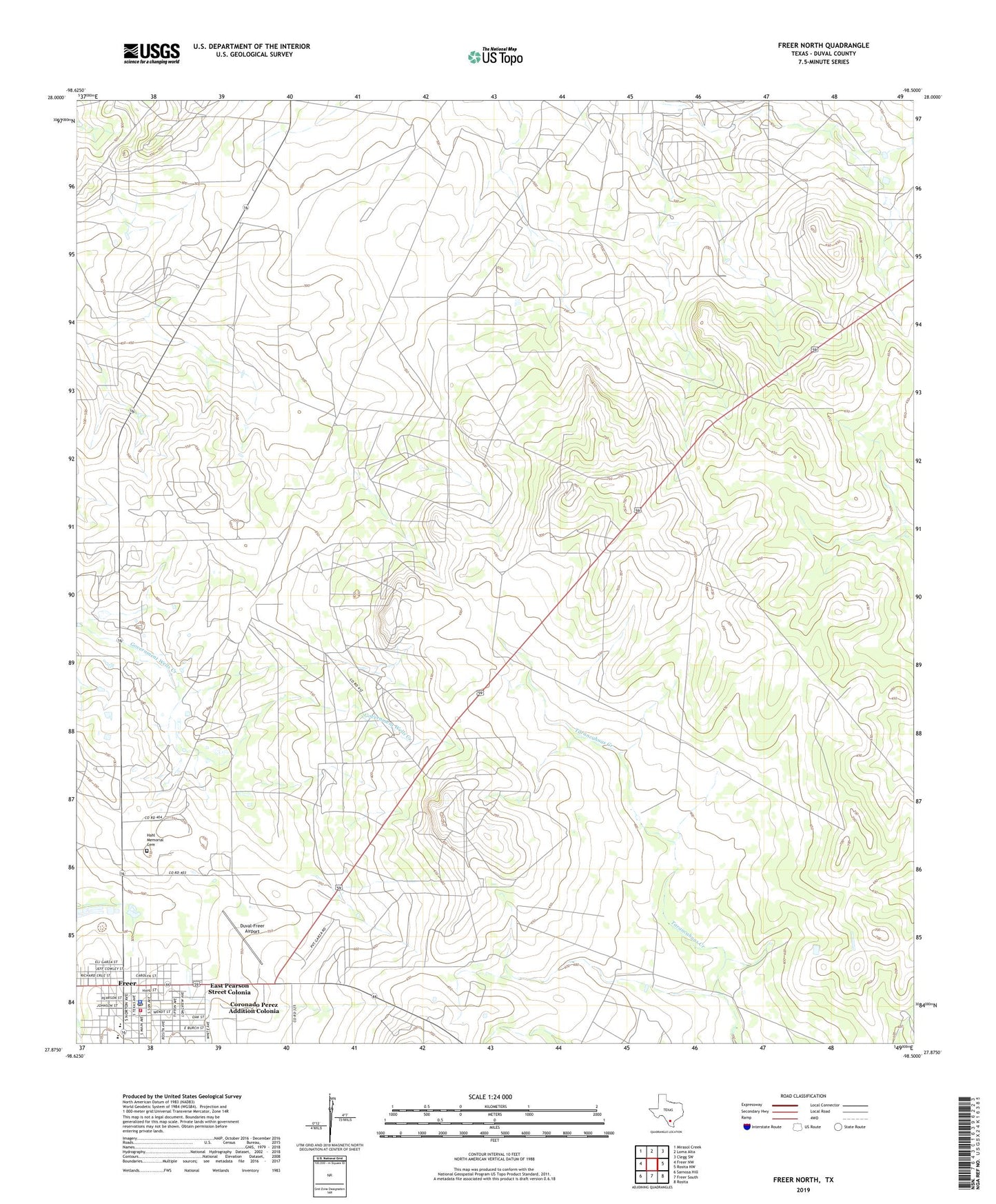
Freer North Texas US Topo Map
Couldn't load pickup availability
2022 topographic map quadrangle Freer North in the state of Texas. Scale: 1:24000. Based on the newly updated USGS 7.5' US Topo map series, this map is in the following counties: Duval. The map contains contour data, water features, and other items you are used to seeing on USGS maps, but also has updated roads and other features. This is the next generation of topographic maps. Printed on high-quality waterproof paper with UV fade-resistant inks.
Quads adjacent to this one:
West: Freer NW
Northwest: Mirasol Creek
North: Loma Alta
Northeast: Clegg SW
East: Rosita NW
Southeast: Rosita
South: Freer South
Southwest: Sarnosa Hill
This map covers the same area as the classic USGS quad with code o27098h5.
Contains the following named places: Bazan Branch Library, City of Freer, Coronado Perez Addition Colonia, Duval-Freer Airport, East Pearson Street Colonia, Freer, Freer City Hall, Freer Police Department, Freer Post Office, Freer Volunteer Fire Department and Emergency Medical Service, Hahl Memorial Cemetery, School Heights Addition Number 2 Colonia, United States Border Patrol Station