MyTopo
Loma Texas US Topo Map
Couldn't load pickup availability
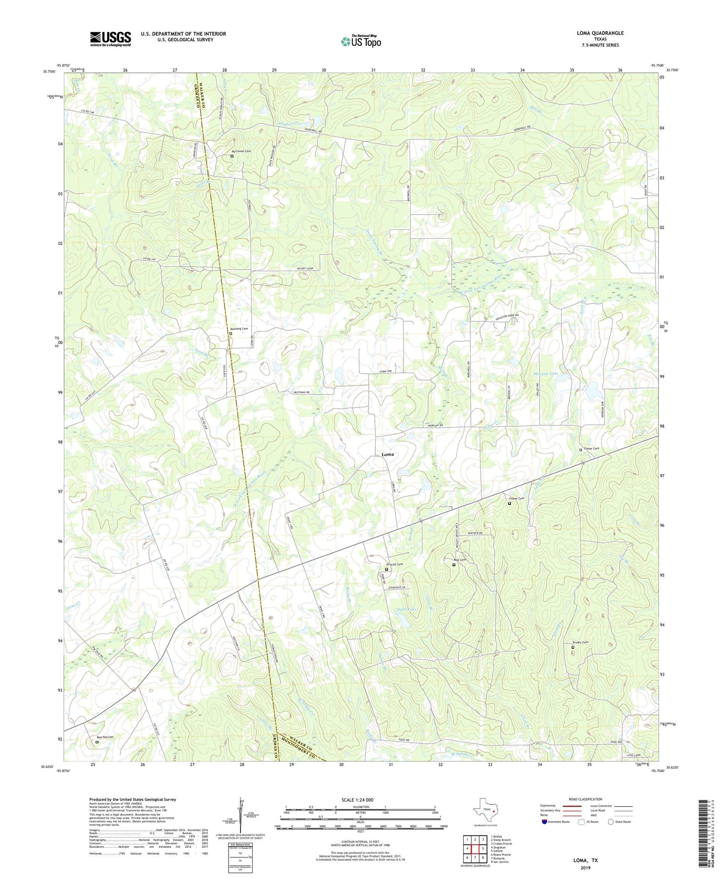
2019 topographic map quadrangle Loma in the state of Texas. Scale: 1:24000. Based on the newly updated USGS 7.5' US Topo map series, this map is in the following counties: Walker, Grimes, Montgomery. The map contains contour data, water features, and other items you are used to seeing on USGS maps, but also has updated roads and other features. This is the next generation of topographic maps. Printed on high-quality waterproof paper with UV fade-resistant inks.
Quads adjacent to this one:
West: Singleton
Northwest: Bedias
North: Steep Branch
Northeast: Crabbs Prairie
East: Galilee
Southeast: San Jacinto
South: Richards
Southwest: Roans Prairie
Contains the following named places: Brushy Cemetery, Cedar Creek, Dennis Branch, Driscoll Cemetery, Duke Lake, Duke Lake Dam, Foster Cemetery, Gum Branch, Hopewell Church, Hopewell School, Kelso Branch, Loma, Lucas Branch, McCowan Cemetery, Midway Church, Mill Branch, Morgan Lake, Morgan South Lake, Morgan South Lake Dam, Mustang Cemetery, Neely Spring Branch, Paces Chapel, Pilgrim Rest Church, Red Top Cemetery, Rocky Creek, Ross Cemetery, Sand Branch, Sweet Home Church, Wesley Grove, Wesley Grove Church, Wesley Grove School