MyTopo
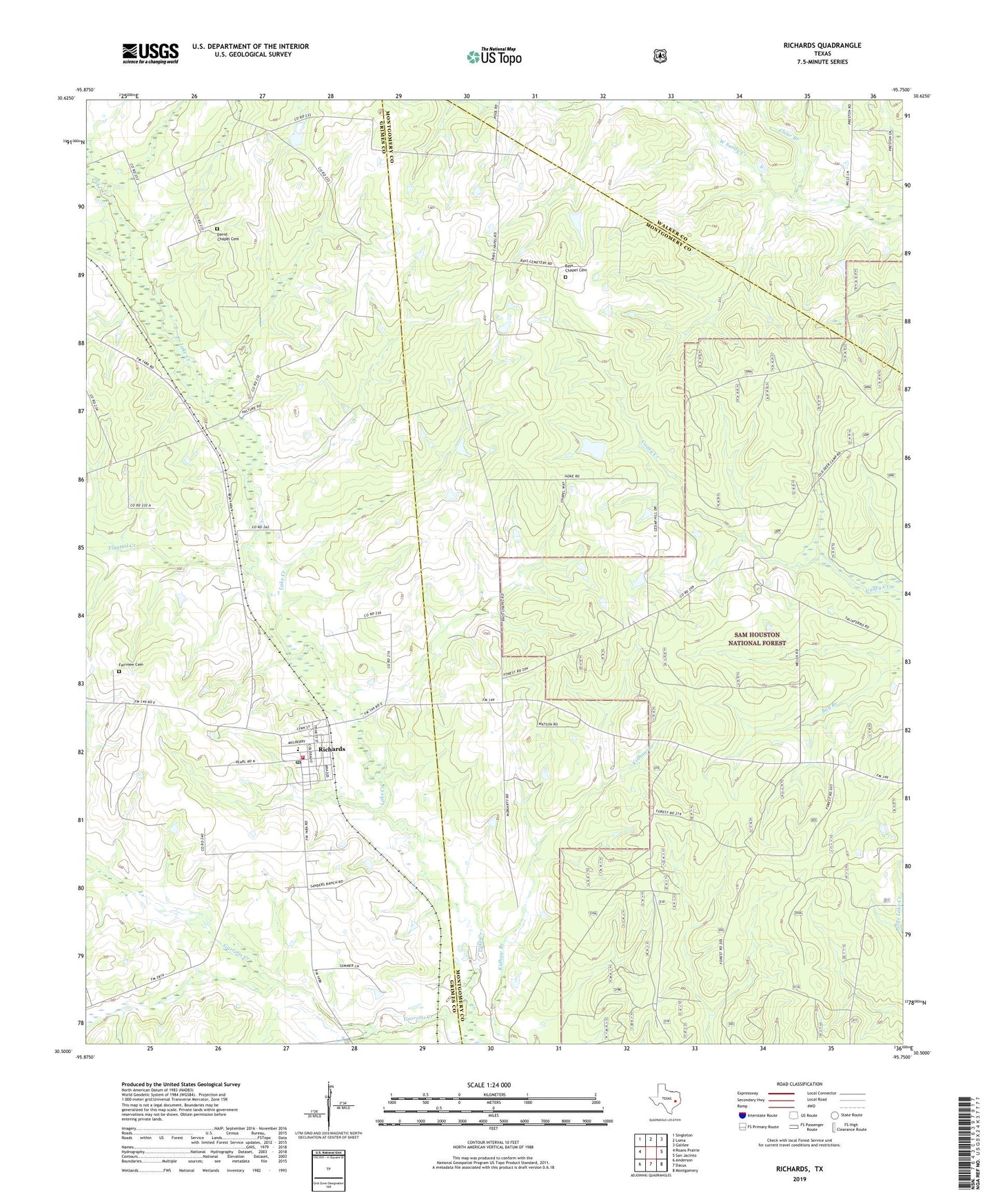
Richards Texas US Topo Map
Couldn't load pickup availability
Also explore the Richards Forest Service Topo of this same quad for updated USFS data
2022 topographic map quadrangle Richards in the state of Texas. Scale: 1:24000. Based on the newly updated USGS 7.5' US Topo map series, this map is in the following counties: Montgomery, Grimes, Walker. The map contains contour data, water features, and other items you are used to seeing on USGS maps, but also has updated roads and other features. This is the next generation of topographic maps. Printed on high-quality waterproof paper with UV fade-resistant inks.
Quads adjacent to this one:
West: Roans Prairie
Northwest: Singleton
North: Loma
Northeast: Galilee
East: San Jacinto
Southeast: Montgomery
South: Dacus
Southwest: Anderson
This map covers the same area as the classic USGS quad with code o30095e7.
Contains the following named places: Bays Chapel, Bays Chapel Cemetery, Clear Branch, David Chapel Cemetery, Fairview Cemetery, Flagtail Creek, Garretts Creek, Longstreet, Red Loop I, Richards, Richards Census Designated Place, Richards Post Office, Richards Volunteer Fire Department, Robinson Hill Church, Rocky Branch, ZIP Code: 77873