MyTopo
Long Branch Texas US Topo Map
Couldn't load pickup availability
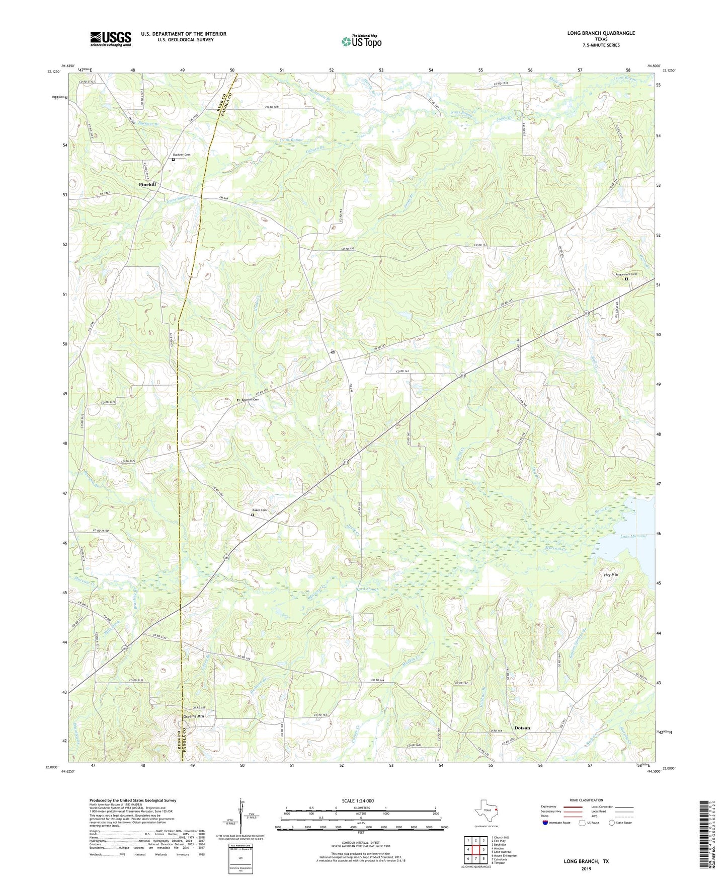
2019 topographic map quadrangle Long Branch in the state of Texas. Scale: 1:24000. Based on the newly updated USGS 7.5' US Topo map series, this map is in the following counties: Panola, Rusk. The map contains contour data, water features, and other items you are used to seeing on USGS maps, but also has updated roads and other features. This is the next generation of topographic maps. Printed on high-quality waterproof paper with UV fade-resistant inks.
Quads adjacent to this one:
West: Minden
Northwest: Church Hill
North: Fair Play
Northeast: Beckville
East: Lake Murvaul
Southeast: Timpson
South: Caledonia
Southwest: Mount Enterprise
Contains the following named places: Baker Cemetery, Bearden Branch, Bethel Church, Billy Ditch, Boynton Cemetery, Brantley Branch, Buckner Branch, Buckner Cemetery, Caney Branch, Cooper Creek, Corinth Church, Dotson, Dry Branch, Friendship Church, Glade Creek, Greems Mountain, Grisham Branch, Hainty Branch, Hog Mountain, Hord Slough, Hudman Branch, Jones Branch, Keaton Springs Branch, Long Branch, Long Branch Post Office, Long Branch-Dotson Division, Madkin Creek, Murphy Creek, New Zion Church, Osburn Branch, Pinehill, Robinson Branch, Roquemore Cemetery, Sand Creek, Shady Grove Church, Shaw Branch, ZIP Code: 75669