MyTopo
Lake Murvaul Texas US Topo Map
Couldn't load pickup availability
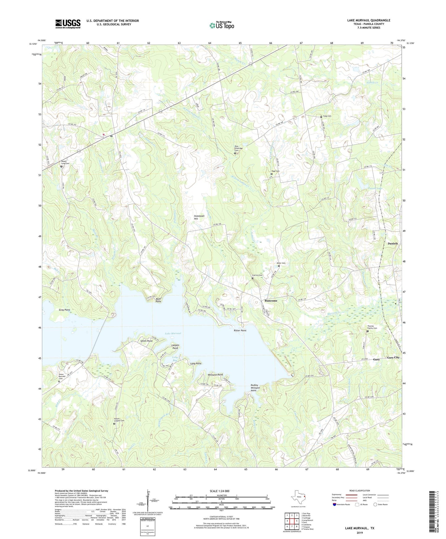
2022 topographic map quadrangle Lake Murvaul in the state of Texas. Scale: 1:24000. Based on the newly updated USGS 7.5' US Topo map series, this map is in the following counties: Panola. The map contains contour data, water features, and other items you are used to seeing on USGS maps, but also has updated roads and other features. This is the next generation of topographic maps. Printed on high-quality waterproof paper with UV fade-resistant inks.
Quads adjacent to this one:
West: Long Branch
Northwest: Fair Play
North: Beckville
Northeast: Carthage
East: Gary
Southeast: Tenaha West
South: Timpson
Southwest: Caledonia
This map covers the same area as the classic USGS quad with code o32094a4.
Contains the following named places: Beck Creek, Bethlehem Church, Boy Scouts of America Camp, Bull Creek, Buncome, Caney Creek, Carrico Cemetery, Clayton, Clayton Post Office, Clayton Volunteer Fire Department, Colo Creek, Daniels, Daniels Ditch, Davis Branch, Dudley Williams Point, East Fork Indian Creek, Fallwell Creek, First Baptist Church, Freewill Church, Gray Point, Heath Long Cemetery, Holly Creek, Holton - Lindsey Cemetery, Indian Creek, Jones Branch, Lake Murvaul, Lampin Point, Long Bay, Long Point, McCoy Church, Miller Cemetery, Moss Point, Mount Bethel Church, Murvaul Bayou Dam, Murvaul Bayou Reservoir, Page Cemetery, Panola Lake, Panola Lake Dam, Pleasant Grove Church, Ritter Point, Ross - Etheridge Cemetery, Sand Creek, Sessums Creek, Smith Point, Snap, Snap Cemetery, Stephenson Creek, Stonewall Hill, Thomas Cemetery, Union Murvaul Cemetery, West Fork Indian Creek, Williams Point, Witherspoon Branch