MyTopo
Timpson Texas US Topo Map
Couldn't load pickup availability
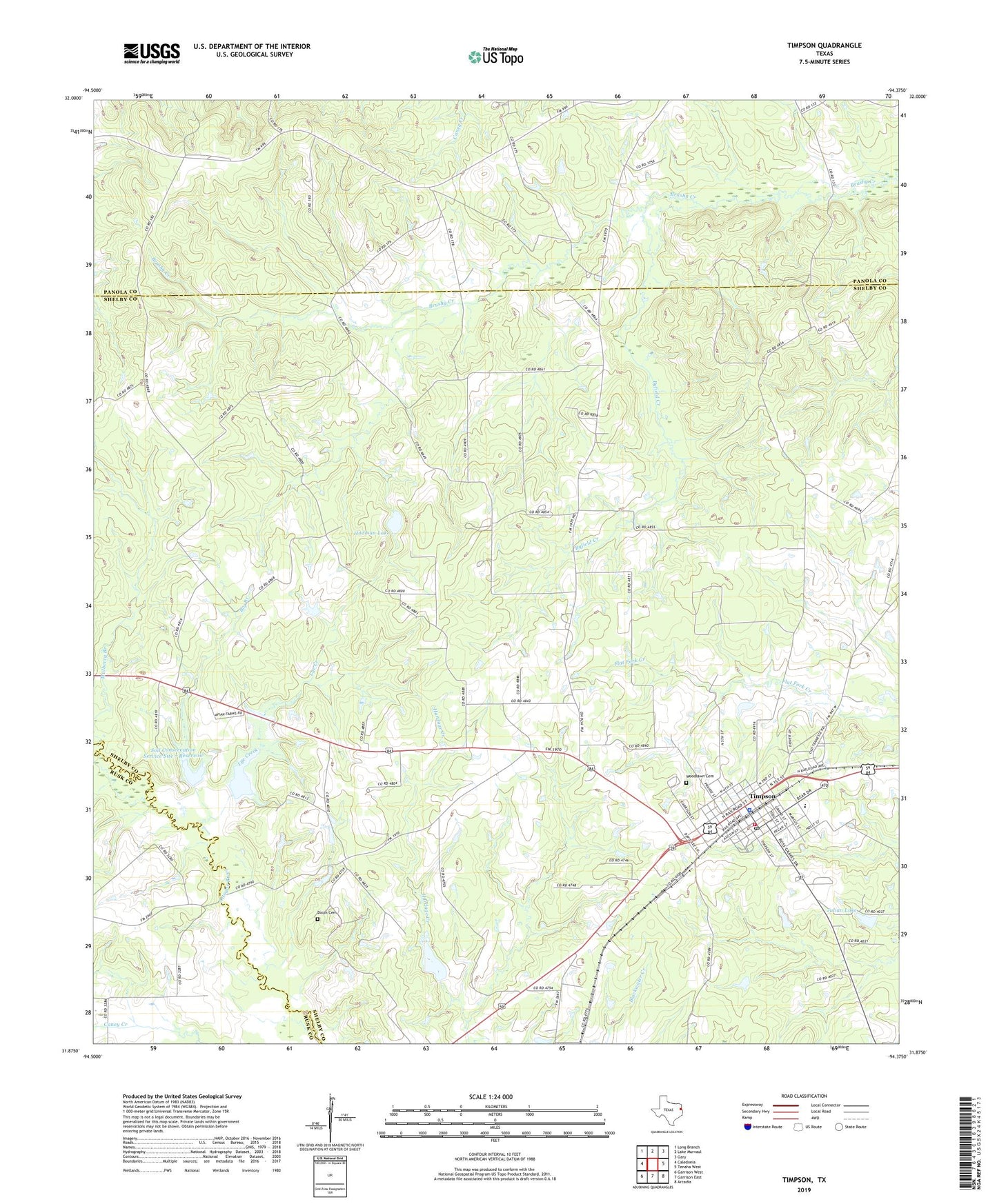
2022 topographic map quadrangle Timpson in the state of Texas. Scale: 1:24000. Based on the newly updated USGS 7.5' US Topo map series, this map is in the following counties: Shelby, Panola, Rusk. The map contains contour data, water features, and other items you are used to seeing on USGS maps, but also has updated roads and other features. This is the next generation of topographic maps. Printed on high-quality waterproof paper with UV fade-resistant inks.
Quads adjacent to this one:
West: Caledonia
Northwest: Long Branch
North: Lake Murvaul
Northeast: Gary
East: Tenaha West
Southeast: Arcadia
South: Garrison East
Southwest: Garrison West
This map covers the same area as the classic USGS quad with code o31094h4.
Contains the following named places: Big Branch, Byfield Creek, City of Timpson, Corinth Church, Dixon Cemetery, Harmony Church, Hudman Lake, Hudman Lake Dam, Julian Lake, Julian Lake Dam, Lye Creek, Mount Zion Church, Soil Conservation Service Site 7 Dam, Soil Conservation Service Site 7 Reservoir, Soil Conservation Service Site 8 Dam, Soil Conservation Service Site 8 Reservoir, Timpson, Timpson City Hall, Timpson City Marshal, Timpson Police Department, Timpson Post Office, Timpson Volunteer Ambulance Service, Timpson Volunteer Fire Department, Todd Spring Church, Weaver Church, Woodlawn Cemetery, ZIP Code: 75975