MyTopo
Minden Texas US Topo Map
Couldn't load pickup availability
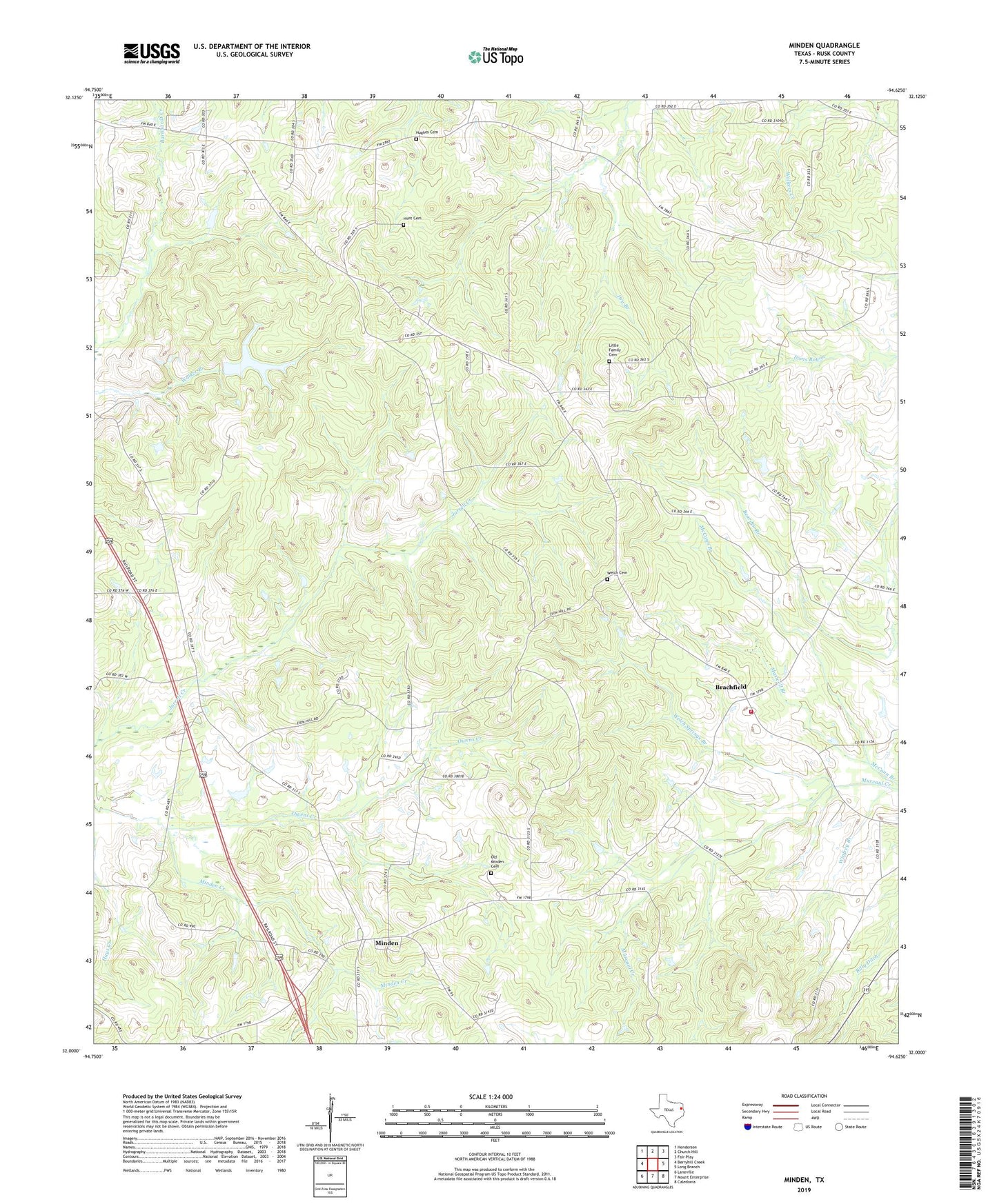
2022 topographic map quadrangle Minden in the state of Texas. Scale: 1:24000. Based on the newly updated USGS 7.5' US Topo map series, this map is in the following counties: Rusk. The map contains contour data, water features, and other items you are used to seeing on USGS maps, but also has updated roads and other features. This is the next generation of topographic maps. Printed on high-quality waterproof paper with UV fade-resistant inks.
Quads adjacent to this one:
West: Berryhill Creek
Northwest: Henderson
North: Church Hill
Northeast: Fair Play
East: Long Branch
Southeast: Caledonia
South: Mount Enterprise
Southwest: Laneville
This map covers the same area as the classic USGS quad with code o32094a6.
Contains the following named places: Brachfield, Dry Branch, Eastside Volunteer Fire Department, Hughes Cemetery, Hunt Cemetery, Lake Manr, Lake Manr Dam, Little Family Cemetery, Lone Star Church, Maple Grove Church, Maxwell Branch, McCann Branch, Minden, Old Minden Cemetery, Owens Creek, Pine Grove Church, Pinehill Division, Pinehurst School, Pleasant Springs Church, Prospect Church, Reese Shiloh Church, Roquemore Church, Welch Cemetery, Welch Springs Branch, Winfrey Branch, Zion Hill Church