MyTopo
Magnolia West Texas US Topo Map
Couldn't load pickup availability
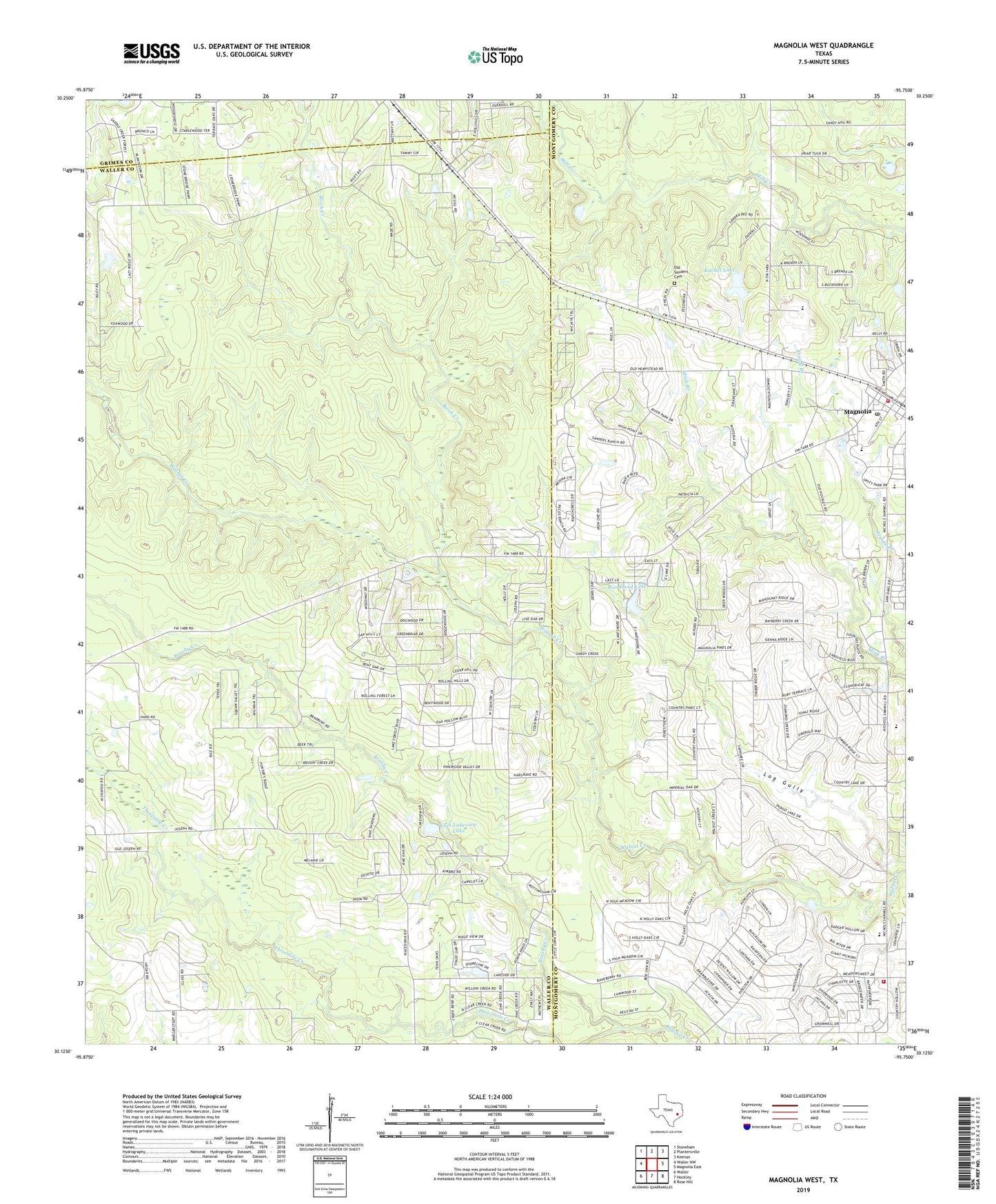
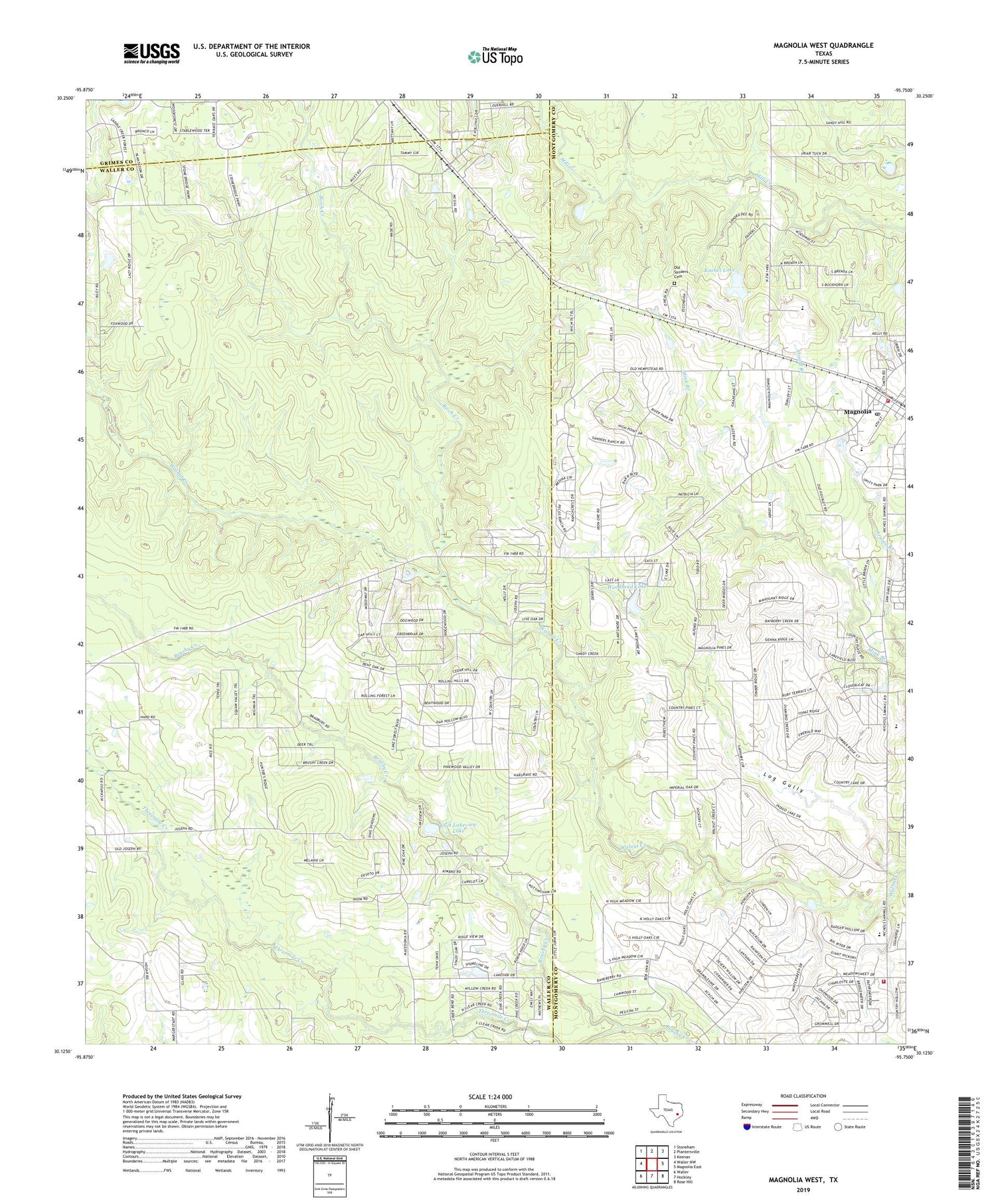
2019 topographic map quadrangle Magnolia West in the state of Texas. Scale: 1:24000. Based on the newly updated USGS 7.5' US Topo map series, this map is in the following counties: Waller, Montgomery, Grimes. The map contains contour data, water features, and other items you are used to seeing on USGS maps, but also has updated roads and other features. This is the next generation of topographic maps. Printed on high-quality waterproof paper with UV fade-resistant inks.
Quads adjacent to this one:
West: Waller NW
Northwest: Stoneham
North: Plantersville
Northeast: Keenan
East: Magnolia East
Southeast: Rose Hill
South: Hockley
Southwest: Waller
Contains the following named places: Assembly of God Church, Birch Creek, Brushy Creek, Club Lakeview Lake, Club Lakeview Lake Dam, Fetzer, J L Lyon Elementary School, Kachel Lake, Kachel Lake Dam, Magnolia, Magnolia Elementary School, Magnolia High School, Magnolia Junior High School, Magnolia Post Office, Magnolia United Methodist Church, Magnolia Volunteer Fire Department Station 183, Montgomery County Constable's Office Precinct 5, Montgomery County Hospital District Emergency Medical Services Station 42, Montgomery County Sheriff's Office - District 4 Patrol, Sanders Cemetery, Threemile Creek, Woodland Lake, Woodland Lake Dam