MyTopo
Hockley Texas US Topo Map
Couldn't load pickup availability
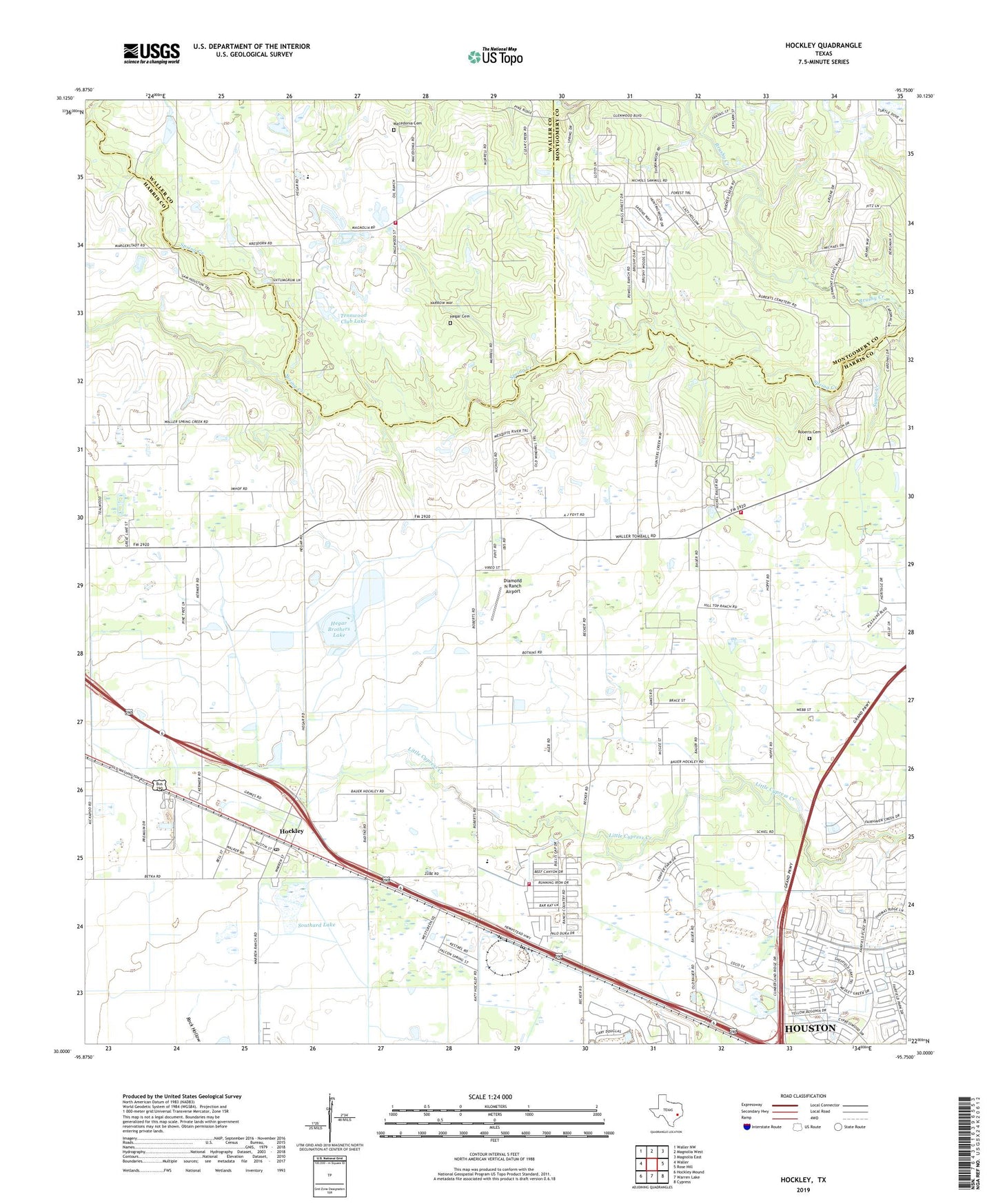
2022 topographic map quadrangle Hockley in the state of Texas. Scale: 1:24000. Based on the newly updated USGS 7.5' US Topo map series, this map is in the following counties: Harris, Waller, Montgomery. The map contains contour data, water features, and other items you are used to seeing on USGS maps, but also has updated roads and other features. This is the next generation of topographic maps. Printed on high-quality waterproof paper with UV fade-resistant inks.
Quads adjacent to this one:
West: Waller
Northwest: Waller NW
North: Magnolia West
Northeast: Magnolia East
East: Rose Hill
Southeast: Cypress
South: Warren Lake
Southwest: Hockley Mound
This map covers the same area as the classic USGS quad with code o30095a7.
Contains the following named places: Becker Road Baptist Church, Biggin Hill Airport, Bremer Farm Dam, Bremer Farm Lake, Cam-Wood Club, Diamond N Ranch Airport, First Church, Hegar, Hegar Brothers Lake, Hegar Brothers Lake Dam, Hegar Cemetery, Hockley, Hockley Post Office, Kickapoo Creek, Macedonia Cemetery, Macedonia Church, New Kentucky Park, Roberts Cemetery, Rosehill Fire Department Station 4, Rosehill Volunteer Fire Department Station 3, Southard Lake, Southard Lake Dam, Sugar Creek, Tenn-Wood Club, Tennwood Club Dam, Tennwood Club Lake, Travis Church, Tri County Fire Department Station 1, Trinity Church, ZIP Code: 77447