MyTopo
Waller Texas US Topo Map
Couldn't load pickup availability
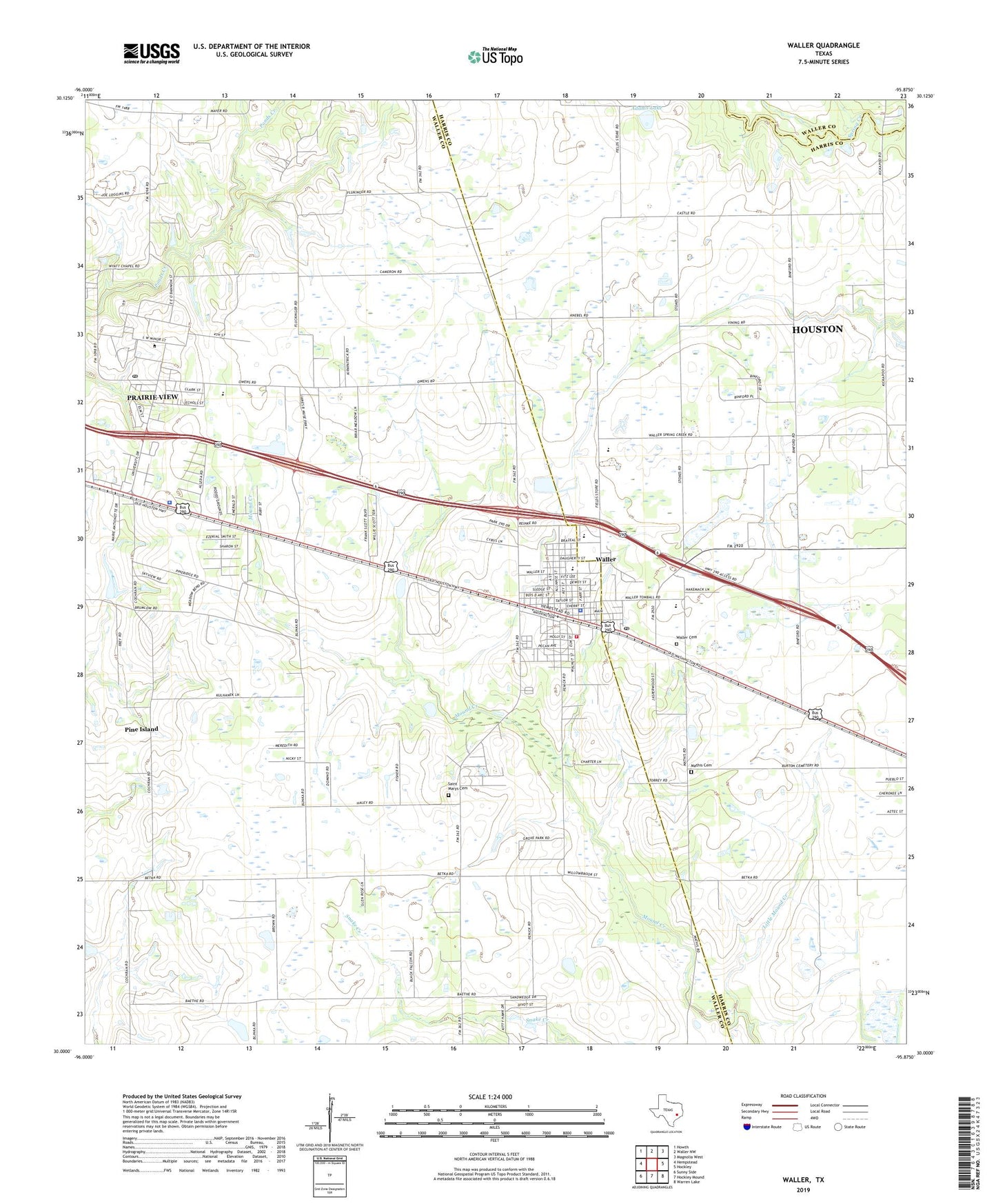
2022 topographic map quadrangle Waller in the state of Texas. Scale: 1:24000. Based on the newly updated USGS 7.5' US Topo map series, this map is in the following counties: Waller, Harris. The map contains contour data, water features, and other items you are used to seeing on USGS maps, but also has updated roads and other features. This is the next generation of topographic maps. Printed on high-quality waterproof paper with UV fade-resistant inks.
Quads adjacent to this one:
West: Hempstead
Northwest: Howth
North: Waller NW
Northeast: Magnolia West
East: Hockley
Southeast: Warren Lake
South: Hockley Mound
Southwest: Sunny Side
This map covers the same area as the classic USGS quad with code o30095a8.
Contains the following named places: Adams Lake, Adams Lake Dam, City of Prairie View, City of Waller, Dennison Lake, Dennison Lake Dam, Faith Baptist Church, Foster Hall, I T Holleman Elementary School, Immanuel Baptist Church, KPVU-FM (Prairie View), Little Mound Creek, Mathis Cemetery, Prairie View, Prairie View A and M College, Prairie View City Hall, Prairie View Police Department, Prairie View Post Office, Saint Marys Cemetery, Schultz Middle School, Shiloh Church, Waller, Waller Baptist Church, Waller Cemetery, Waller City Hall, Waller County, Waller County Volunteer Emergency Medical Services, Waller Junior High School, Waller Police Department, Waller Post Office, Waller Volunteer Fire Department, ZIP Codes: 77446, 77484