MyTopo
Mallard Hill Texas US Topo Map
Couldn't load pickup availability
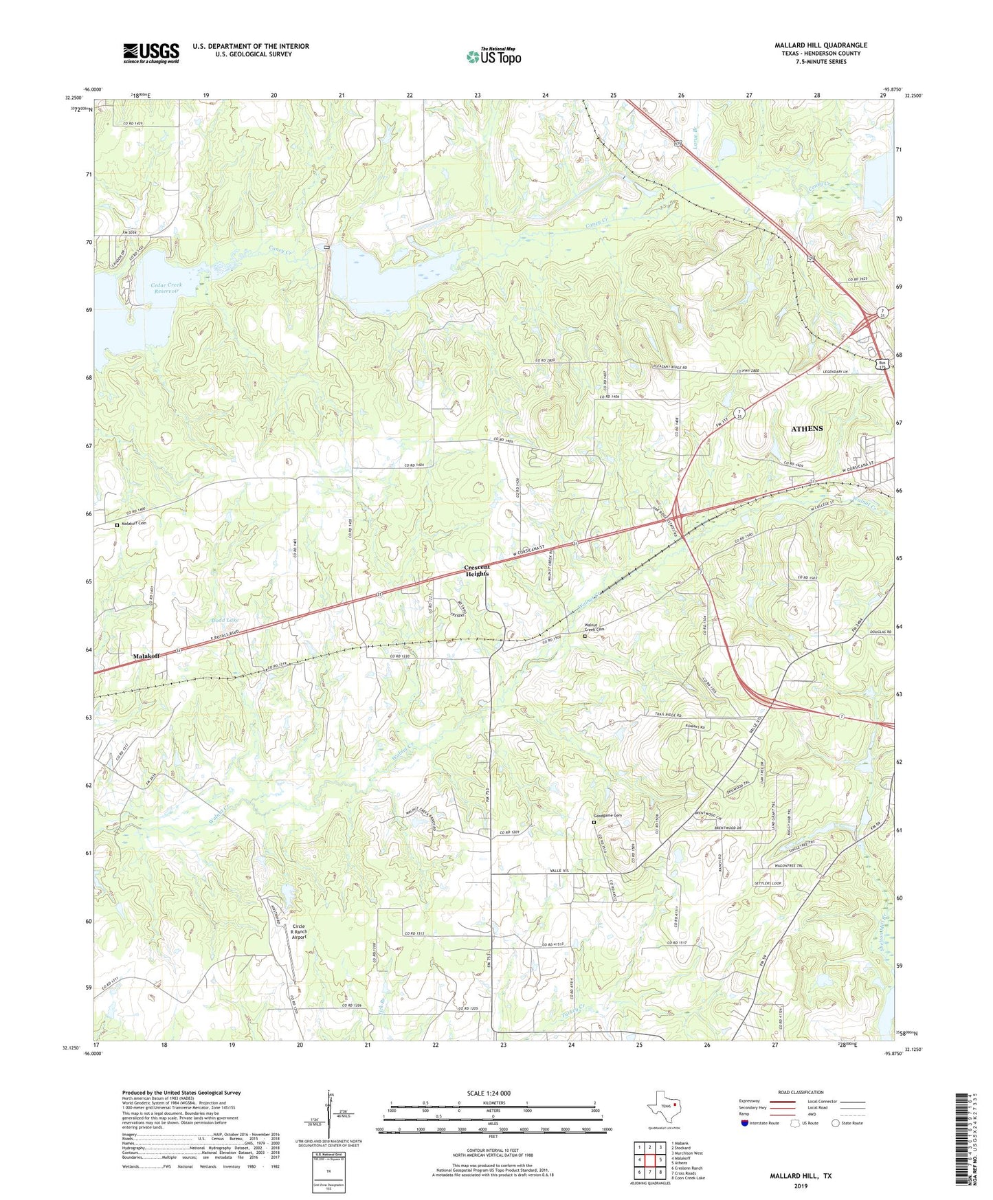
2019 topographic map quadrangle Mallard Hill in the state of Texas. Scale: 1:24000. Based on the newly updated USGS 7.5' US Topo map series, this map is in the following counties: Henderson. The map contains contour data, water features, and other items you are used to seeing on USGS maps, but also has updated roads and other features. This is the next generation of topographic maps. Printed on high-quality waterproof paper with UV fade-resistant inks.
Quads adjacent to this one:
West: Malakoff
Northwest: Mabank
North: Stockard
Northeast: Murchison West
East: Athens
Southeast: Coon Creek Lake
South: Cross Roads
Southwest: Creslenn Ranch
Contains the following named places: Circle R Ranch Airport, Crescent Heights, Crescent Heights Baptist Church, Dauphin, Dodd Lake, First Assembly of God Church, Forest Grove Dam, Forest Grove Reservoir, Goodgame Cemetery, Henderson County Constable's Office Precinct 5, Hollywood Lake, KCKL-FM (Malakoff), Larue Branch, Malakoff Cemetery, Mine Number Five, Onemile Creek, Saint John Lutheran Church, Second Caney Creek, Smith Cemetery, Texas Department of Public Safety - Highway Patrol Office, Third Caney Creek, Tri-Cities Gas Field, Tri-City Church, Walnut Creek Cemetery