MyTopo
Marshall NW Texas US Topo Map
Couldn't load pickup availability
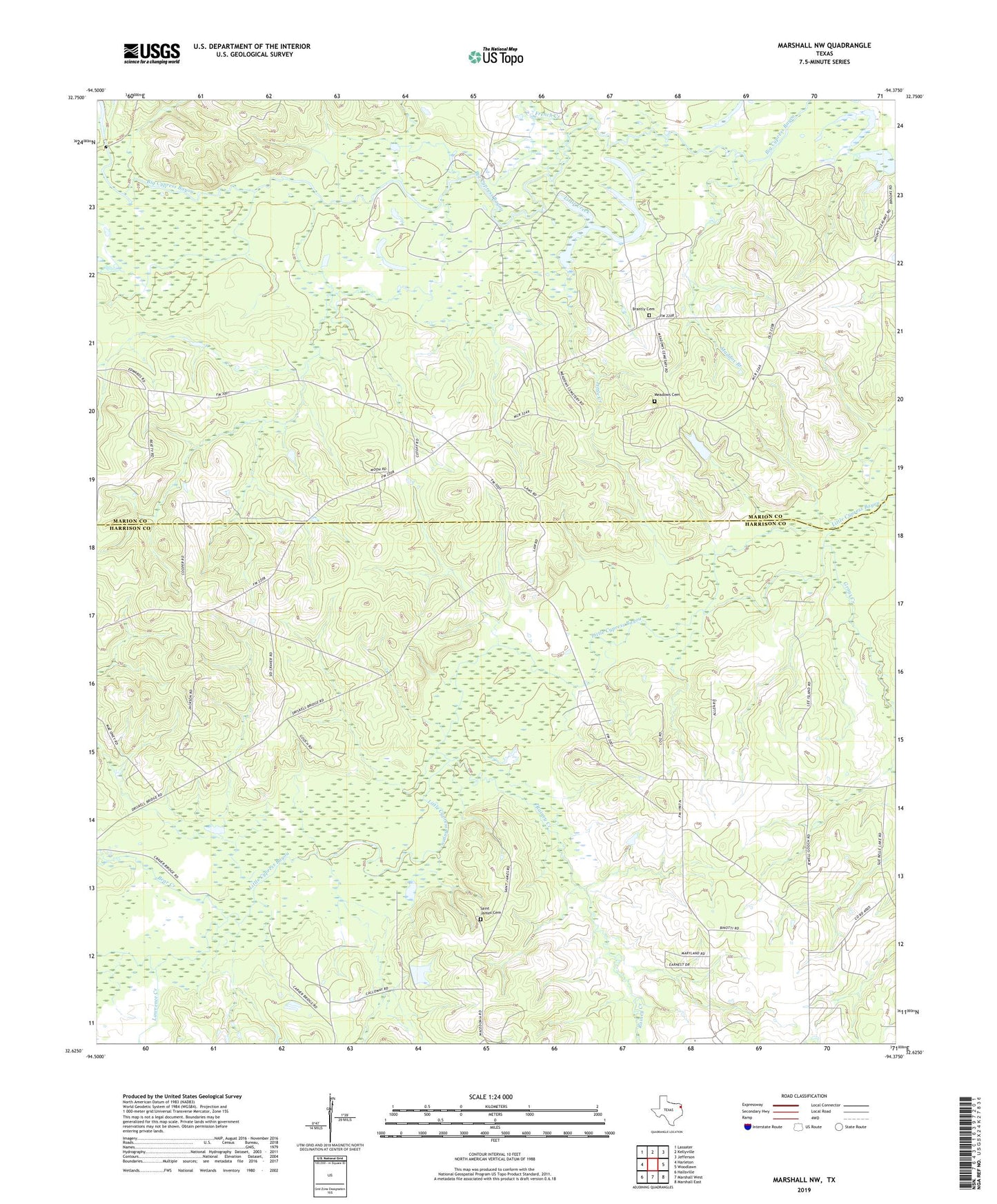
2019 topographic map quadrangle Marshall NW in the state of Texas. Scale: 1:24000. Based on the newly updated USGS 7.5' US Topo map series, this map is in the following counties: Harrison, Marion. The map contains contour data, water features, and other items you are used to seeing on USGS maps, but also has updated roads and other features. This is the next generation of topographic maps. Printed on high-quality waterproof paper with UV fade-resistant inks.
Quads adjacent to this one:
West: Harleton
Northwest: Lassater
North: Kellyville
Northeast: Jefferson
East: Woodlawn
Southeast: Marshall East
South: Marshall West
Southwest: Hallsville
Contains the following named places: Bear Creek, Brantly Cemetery, Evergreen Church, French Creek, Friendly School, Goodwill Church, Grays Creek, Hickory Grove Church, Lawrence Creek, Little Creek, Maddox Branch, Meadows Cemetery, Mount Pleasant Church, New Hope Church, New Zion Church, Rainey Creek, Saint James Cemetery, Saint James Church, Saint Mark Church, Vickie Lynn Oil Field