
MyTopo
McDowell Creek Texas US Topo Map
Couldn't load pickup availability
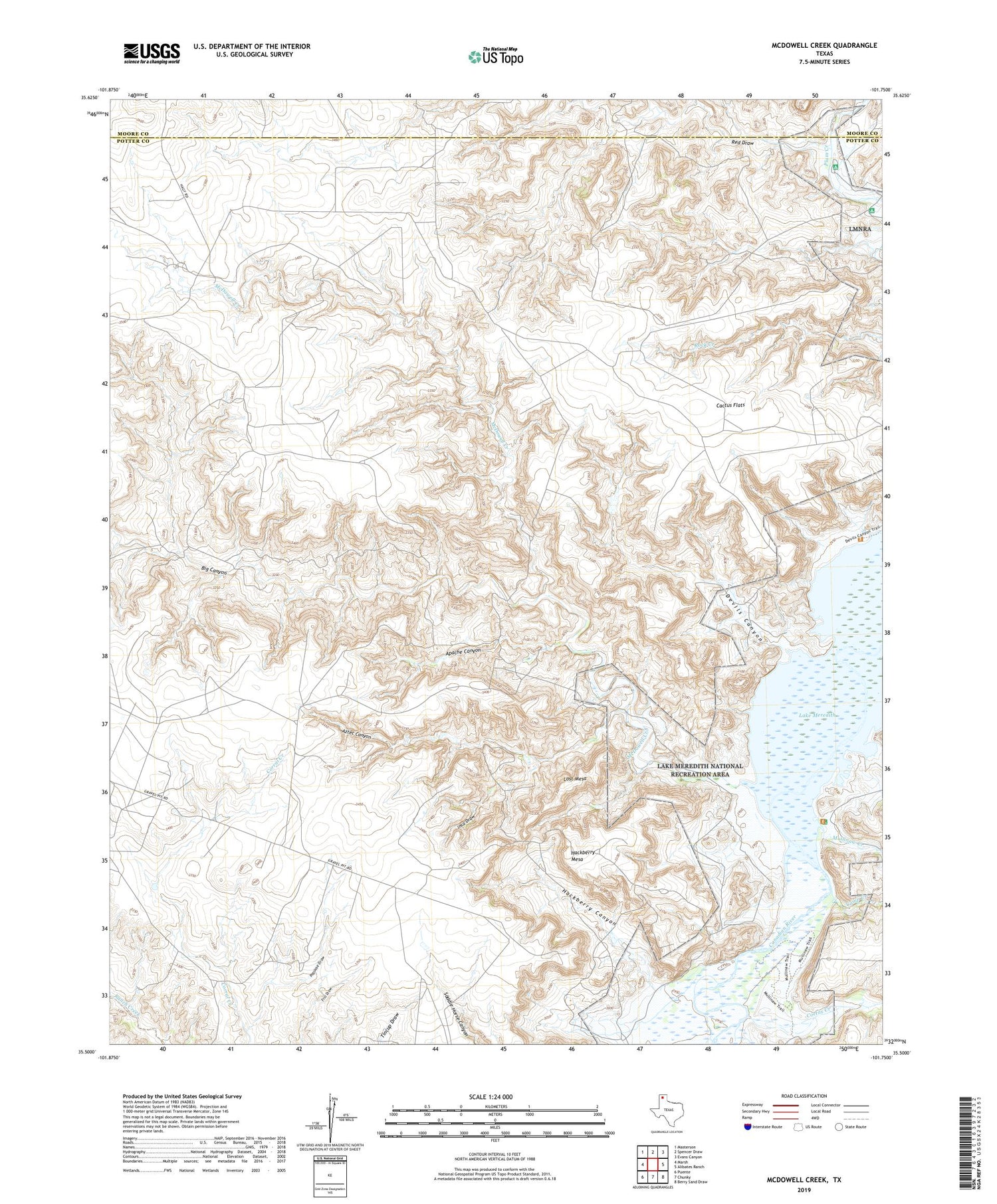
2019 topographic map quadrangle McDowell Creek in the state of Texas. Scale: 1:24000. Based on the newly updated USGS 7.5' US Topo map series, this map is in the following counties: Potter, Moore. The map contains contour data, water features, and other items you are used to seeing on USGS maps, but also has updated roads and other features. This is the next generation of topographic maps. Printed on high-quality waterproof paper with UV fade-resistant inks.
Quads adjacent to this one:
West: Marsh
Northwest: Masterson
North: Spencer Draw
Northeast: Evans Canyon
East: Alibates Ranch
Southeast: Berry Sand Draw
South: Chunky
Southwest: Puente
Contains the following named places: Apache Canyon, Aztec Canyon, Big Canyon, Cactus Flats, Camp Creek, Coetas Creek, Devils Canyon, Hackberry Canyon, Hackberry Mesa, Inca Draw, Lost Mesa, McDowell Creek, Mullinaw Creek, Papoose Draw, Red Draw, ZIP Code: 79058


