MyTopo
McLean Texas US Topo Map
Couldn't load pickup availability
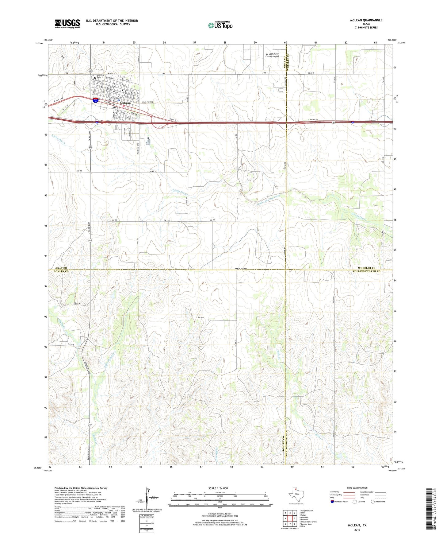
2022 topographic map quadrangle McLean in the state of Texas. Scale: 1:24000. Based on the newly updated USGS 7.5' US Topo map series, this map is in the following counties: Gray, Donley, Wheeler, Collingsworth. The map contains contour data, water features, and other items you are used to seeing on USGS maps, but also has updated roads and other features. This is the next generation of topographic maps. Printed on high-quality waterproof paper with UV fade-resistant inks.
Quads adjacent to this one:
West: Alanreed
Northwest: Hudgens Ranch
North: Back
Northeast: Pakan
East: Ramsdell
Southeast: Abra
South: Spencer Lake
Southwest: Troublesome Creek
This map covers the same area as the classic USGS quad with code o35100b5.
Contains the following named places: Gray County Sheriff's Office, Hillcrest Cemetery, Historical Museum of Barbed Wire and Fencing Tools, Little Skillet Creek, McLean, McLean City Hall, McLean Emergency Medical Service, McLean Post Office, McLean School, McLean Volunteer Fire Department, McLean/Gray County Airport, Town of McLean