MyTopo
Medina Lake Texas US Topo Map
Couldn't load pickup availability
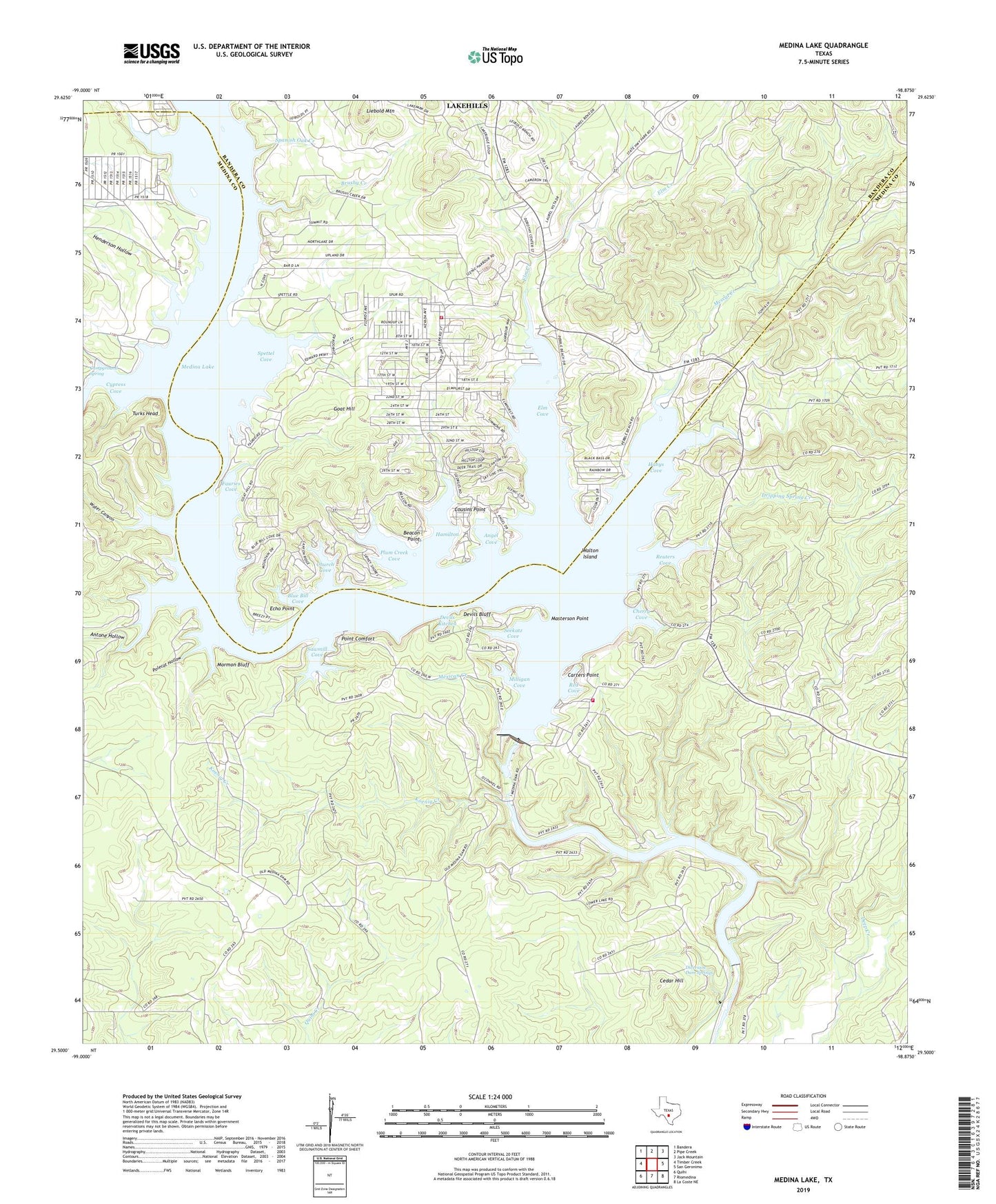
2019 topographic map quadrangle Medina Lake in the state of Texas. Scale: 1:24000. Based on the newly updated USGS 7.5' US Topo map series, this map is in the following counties: Medina, Bandera. The map contains contour data, water features, and other items you are used to seeing on USGS maps, but also has updated roads and other features. This is the next generation of topographic maps. Printed on high-quality waterproof paper with UV fade-resistant inks.
Quads adjacent to this one:
West: Timber Creek
Northwest: Bandera
North: Pipe Creek
Northeast: Jack Mountain
East: San Geronimo
Southeast: La Coste NE
South: Riomedina
Southwest: Quihi
Contains the following named places: Angel Cove, Antone Hollow, Baltzells Las Brisas Heliport, Bandara County Park, Bandera County Park, Bandera County Sheriff's Office, Beacon Point, Blue Bill Cove, Brushy Creek, Campground Spring, Carters Point, Cedar Hill, Cherry Cove, Church Cove, Cousins Point, Cypress Cove, Devils Bluff, Devils Kitchen, Diversion Dam Springs, Diversion Lake, Dripping Spring Creek, Echo Point, Elm Cove, Elm Creek, Fauries Cove, Goat Hill, Habys Cove, Hamilton, Henderson Hollow, Koenig Creek, KRRT-TV (Kerrville), Lake Hills, Lake Medina Highlands, Lakehills, Lakehills Census Designated Place, Liebold Mountain, Masterson Heliport, Masterson Point, Medina Dam, Medina Diversion Lake Dam, Medina Lake, Medina Lake Volunteer Fire Department Station 1, Mescal Creek, Mexican Creek, Mico, Mico Volunteer Fire Department Base Station, Milligan Cove, Mormon Bluff, Plum Creek Cove, Point Comfort, Polecat Hollow, Red Cove, Reuters Cove, Rocky Creek, Saint Francis Chapel, Saint Victors Chapel, Sawmill Cove, Seekatz Cove, Spanish Oak Creek, Spettel Cove, Turks Head, Walton Island, Water Canyon, ZIP Code: 78056