MyTopo
Bandera Texas US Topo Map
Couldn't load pickup availability
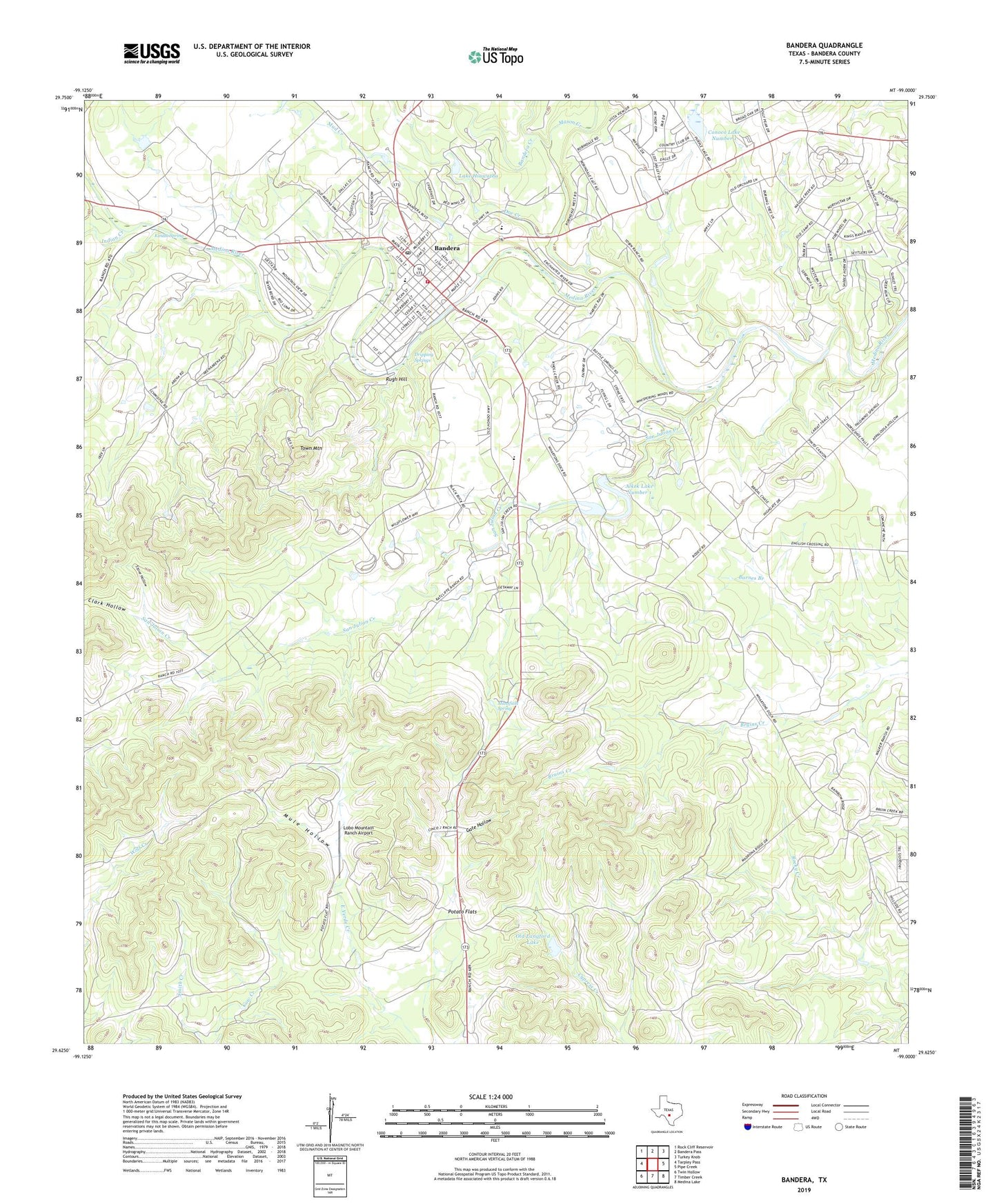
2022 topographic map quadrangle Bandera in the state of Texas. Scale: 1:24000. Based on the newly updated USGS 7.5' US Topo map series, this map is in the following counties: Bandera. The map contains contour data, water features, and other items you are used to seeing on USGS maps, but also has updated roads and other features. This is the next generation of topographic maps. Printed on high-quality waterproof paper with UV fade-resistant inks.
Quads adjacent to this one:
West: Tarpley Pass
Northwest: Rock Cliff Reservoir
North: Bandera Pass
Northeast: Turkey Knob
East: Pipe Creek
Southeast: Medina Lake
South: Timber Creek
Southwest: Twin Hollow
This map covers the same area as the classic USGS quad with code o29099f1.
Contains the following named places: Alkek Lake Number 1, Alkek Lake Number 1 Dam, Alkek Lake Number 2, Alkek Lake Number 2 Dam, Bandera, Bandera Cemetery, Bandera City Hall, Bandera County Constable's Office Precinct 1, Bandera County Emergency Medical Services, Bandera Creek, Bandera Division, Bandera Middle School, Bandera Police Department, Bandera Post Office, Bandera Volunteer Fire Department, City of Bandera, Clark Hollow, Conoco Lake Dam Number 1, Conoco Lake Number 1, Doe Creek, Dripping Springs, Flying L Ranch Airport, Frontier Times Museum, Gate Hollow, Indian Creek, Jureczki House, Kindla Spring, Lake Hiawatha, Lobo Mountain Ranch Airport, Mansfield Spring, Mason Creek, Mud Creek, Mule Hollow, Old Langford Lake, Old Langford Lake Dam, Potato Flats, Rugh Hill, Saint Joseph School, San Julian Creek, Stove Hollow, Town Mountain, ZIP Code: 78003