MyTopo
Melvin Texas US Topo Map
Couldn't load pickup availability
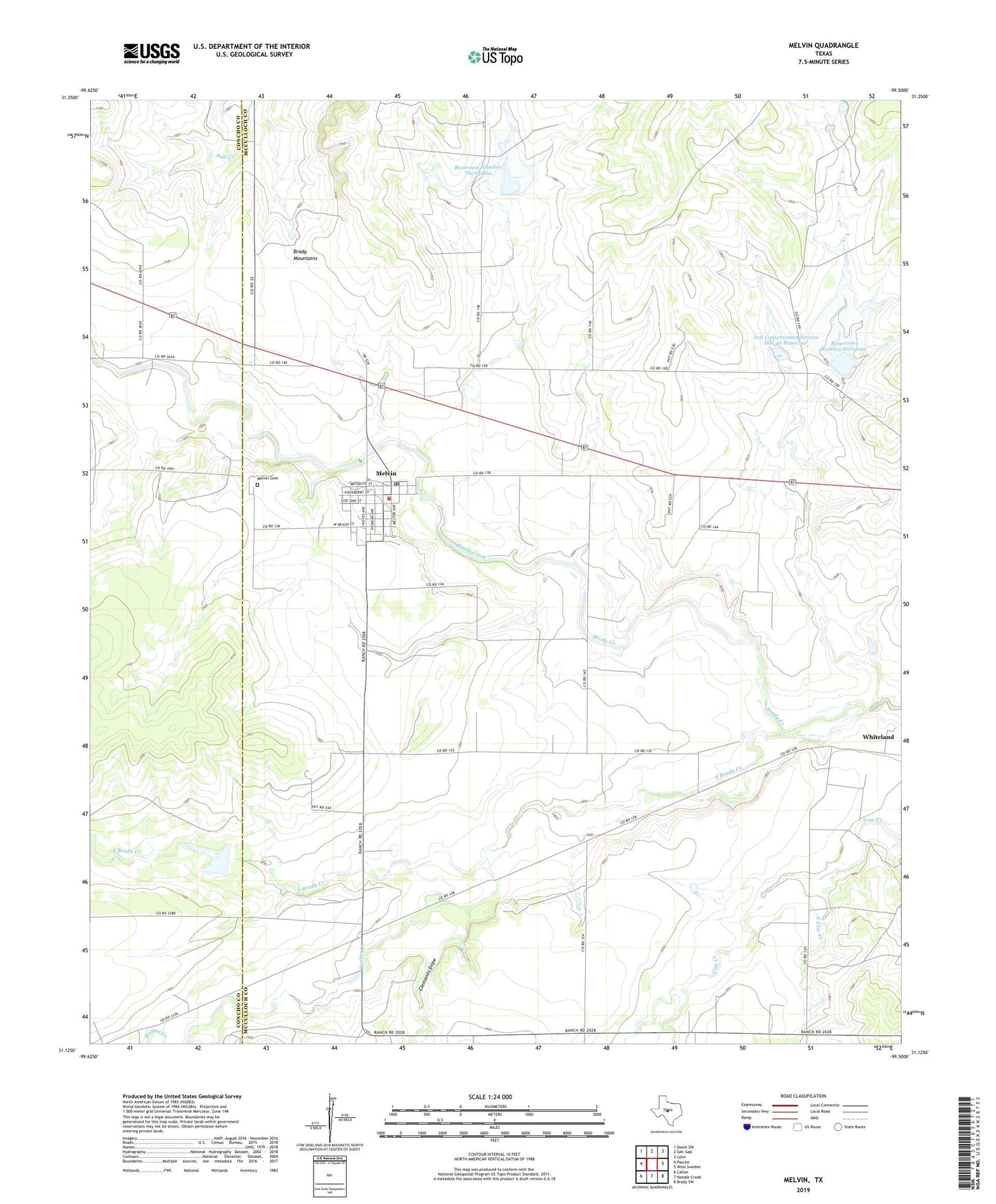
2022 topographic map quadrangle Melvin in the state of Texas. Scale: 1:24000. Based on the newly updated USGS 7.5' US Topo map series, this map is in the following counties: McCulloch, Concho. The map contains contour data, water features, and other items you are used to seeing on USGS maps, but also has updated roads and other features. This is the next generation of topographic maps. Printed on high-quality waterproof paper with UV fade-resistant inks.
Quads adjacent to this one:
West: Pasche
Northwest: Doole SW
North: Salt Gap
Northeast: Lohn
East: West Sweden
Southeast: Brady SW
South: Needle Creek
Southwest: Callan
This map covers the same area as the classic USGS quad with code o31099b5.
Contains the following named places: Clements Draw, East Cow Creek, Homer Junction, Lightner, Marco, Melvin, Melvin Cemetery, Melvin City Office, Melvin Post Office, Melvin Volunteer Fire Department, Needle Creek, Reservoir Number Forty, Reservoir Number Fortyone, Reservoir Number Thirtynine, Reubes Creek, Saddle Creek, Soil Conservation Service Site 17 Dam, Soil Conservation Service Site 17 Reservoir, Soil Conservation Service Site 39 Dam, Soil Conservation Service Site 40 Dam, Soil Conservation Service Site 40 Reservoir, Soil Conservation Service Site 41 Dam, South Brady Creek, Town of Melvin, Whiteland, ZIP Code: 76858