MyTopo
Raven Creek South Texas US Topo Map
Couldn't load pickup availability
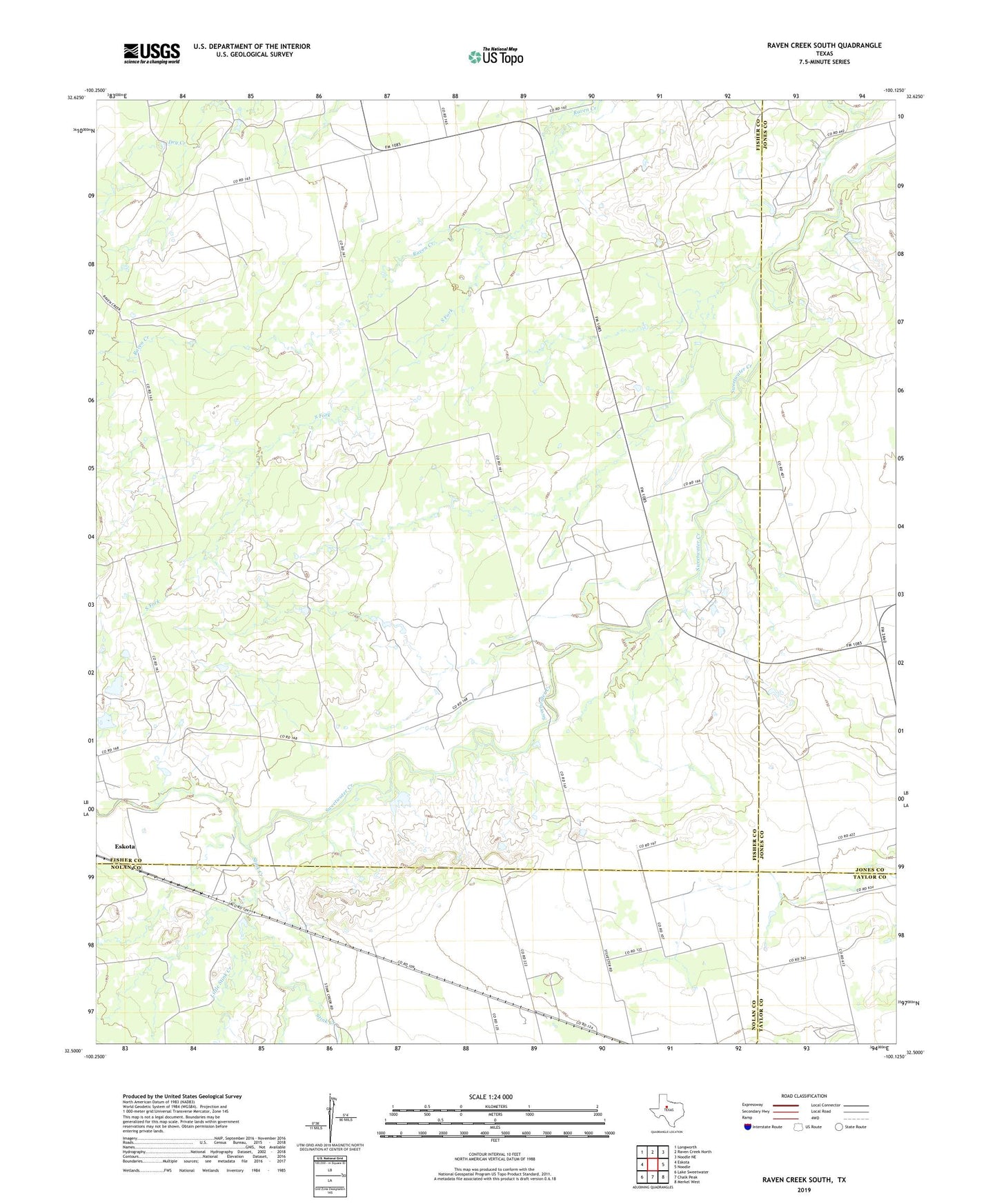
2022 topographic map quadrangle Raven Creek South in the state of Texas. Scale: 1:24000. Based on the newly updated USGS 7.5' US Topo map series, this map is in the following counties: Fisher, Nolan, Jones, Taylor. The map contains contour data, water features, and other items you are used to seeing on USGS maps, but also has updated roads and other features. This is the next generation of topographic maps. Printed on high-quality waterproof paper with UV fade-resistant inks.
Quads adjacent to this one:
West: Eskota
Northwest: Longworth
North: Raven Creek North
Northeast: Noodle NE
East: Noodle
Southeast: Merkel West
South: Chalk Peak
Southwest: Lake Sweetwater
This map covers the same area as the classic USGS quad with code o32100e2.
Contains the following named places: Eskota, Little Stink Creek, Newman Cemetery, Newman Church, Raven Creek Oil Field, South Fork, Stink Creek, White Flat Gas Plant, ZIP Code: 79561