MyTopo
Mills Bennett Texas US Topo Map
Couldn't load pickup availability
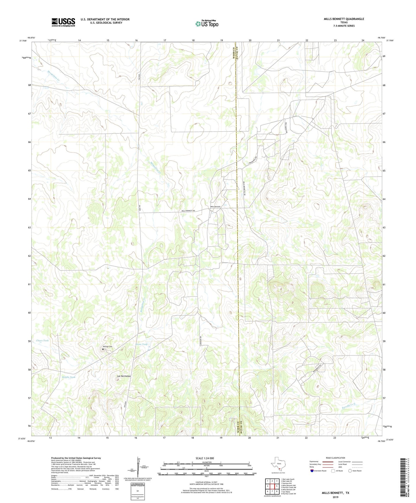
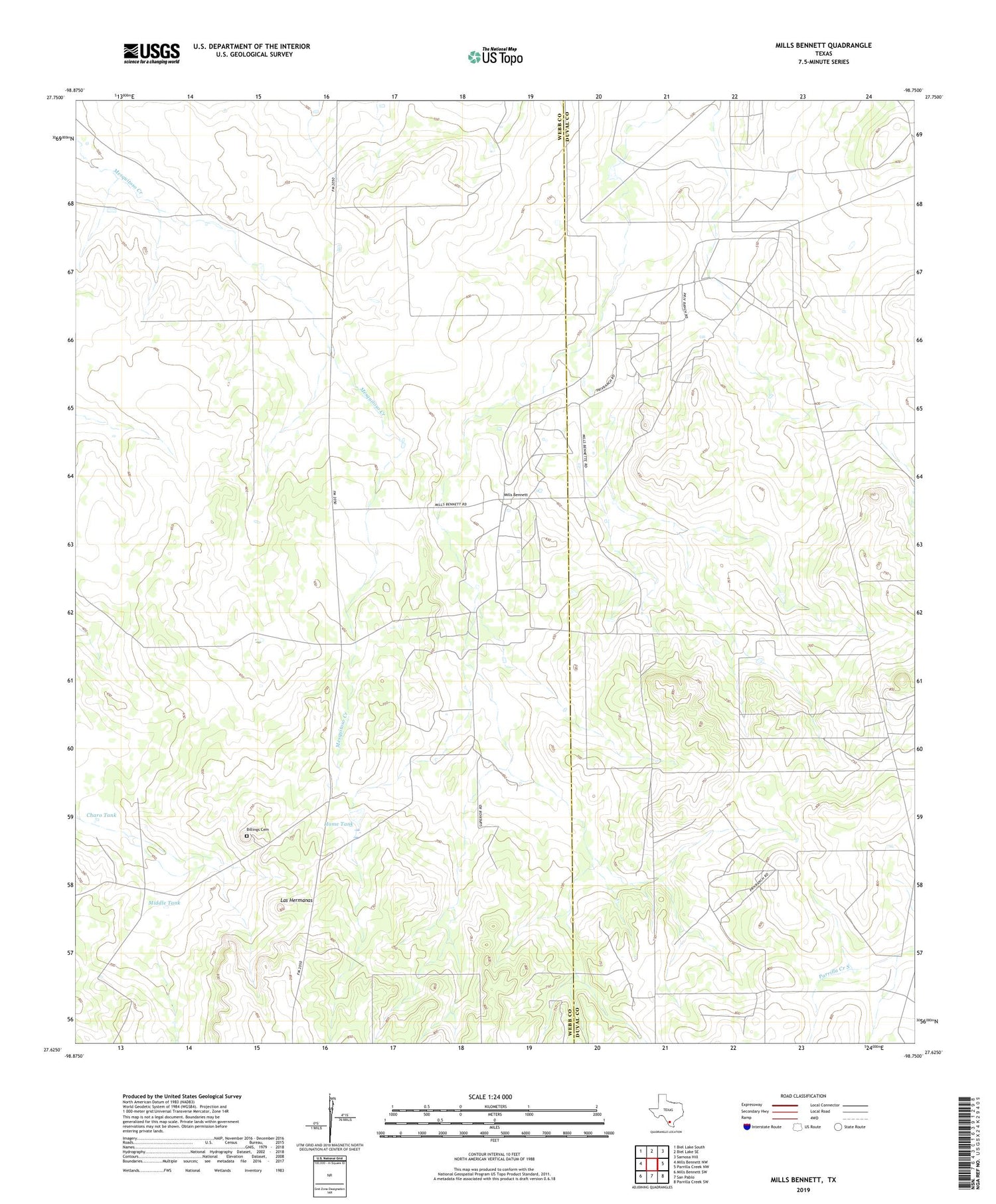
2019 topographic map quadrangle Mills Bennett in the state of Texas. Scale: 1:24000. Based on the newly updated USGS 7.5' US Topo map series, this map is in the following counties: Webb, Duval. The map contains contour data, water features, and other items you are used to seeing on USGS maps, but also has updated roads and other features. This is the next generation of topographic maps. Printed on high-quality waterproof paper with UV fade-resistant inks.
Quads adjacent to this one:
West: Mills Bennett NW
Northwest: Biel Lake South
North: Biel Lake SE
Northeast: Sarnosa Hill
East: Parrilla Creek NW
Southeast: Parrilla Creek SW
South: San Pablo
Southwest: Mills Bennett SW
Contains the following named places: Billings Cemetery, Billings Ranch, Charo Tank, Home Tank, Las Hermanas, Lopez Oil Field, Middle Tank, Middle Well, Mills Bennett