MyTopo
Monahans Texas US Topo Map
Couldn't load pickup availability
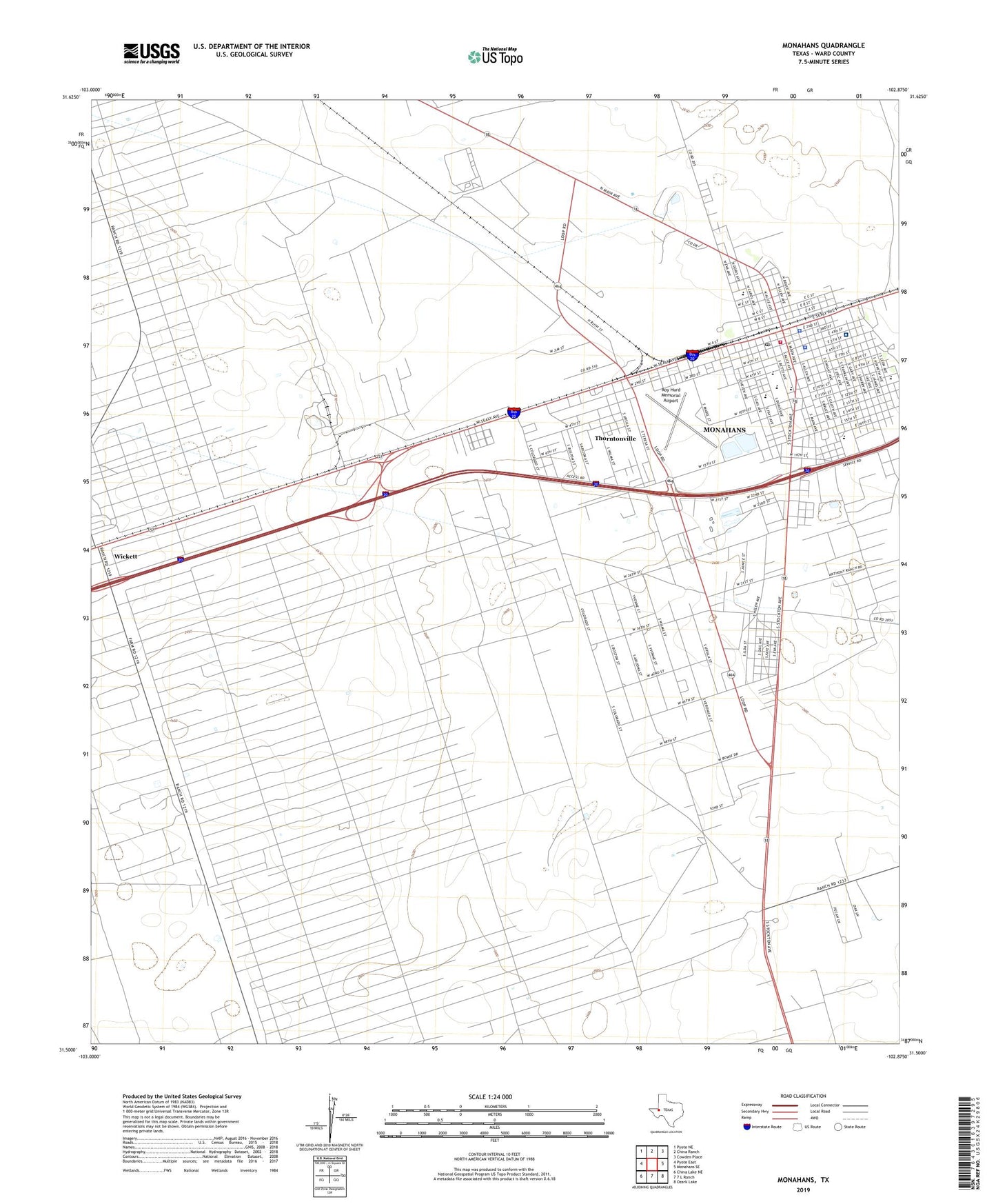
2022 topographic map quadrangle Monahans in the state of Texas. Scale: 1:24000. Based on the newly updated USGS 7.5' US Topo map series, this map is in the following counties: Ward. The map contains contour data, water features, and other items you are used to seeing on USGS maps, but also has updated roads and other features. This is the next generation of topographic maps. Printed on high-quality waterproof paper with UV fade-resistant inks.
Quads adjacent to this one:
West: Pyote East
Northwest: Pyote NE
North: China Ranch
Northeast: Cowden Place
East: Monahans SE
Southeast: Ozark Lake
South: 7 L Ranch
Southwest: China Lake NE
This map covers the same area as the classic USGS quad with code o31102e8.
Contains the following named places: Allen Park, Apostolic Church, Bitter Well, Blueberry Windmill, Browne School, Church of Christ, Duffey Park, Edwards Elementary School, Edwards School, First Baptist Church, First Presbyterian Church, Hill Park, Honky Tonk Well, Lobo Stadium, Middle Well, Million Barrel Museum, Monahans, Monahans City Hall, Monahans Division, Monahans Education Center, Monahans High School, Monahans Memorial Cemetery, Monahans Police Department, Monahans Post Office, Monahans Volunteer Fire Department, North Windmill, Pearson Park, Rose of Sharon Assembly of God Church, Roy Hurd Memorial Airport, Rudy Park, Saint Paul Lutheran Church, South Well, Southwest Sandhill Census Designated Place, Sudderth Elementary School, Tatom Elementary School, Thorntonville, Thorntonville Town Hall, Town of Thorntonville, Wagonwheel Ranch, Walker Junior High School, Ward County Constable's Office Precinct 1, Ward County Courthouse, Ward County Sheriff's Office, Ward Estes North Oil Field, Ward Memorial Hospital, West Windmill, ZIP Code: 79788