MyTopo
Mosheim Texas US Topo Map
Couldn't load pickup availability
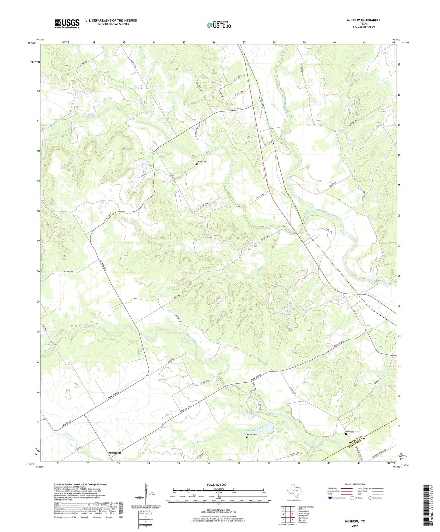
2019 topographic map quadrangle Mosheim in the state of Texas. Scale: 1:24000. Based on the newly updated USGS 7.5' US Topo map series, this map is in the following counties: Bosque, McLennan. The map contains contour data, water features, and other items you are used to seeing on USGS maps, but also has updated roads and other features. This is the next generation of topographic maps. Printed on high-quality waterproof paper with UV fade-resistant inks.
Quads adjacent to this one:
West: Hurst Spring
Northwest: Sugarloaf Mountain
North: Clifton
Northeast: Laguna Park
East: Valley Mills
Southeast: Crawford
South: Coryell
Southwest: Turnersville
Contains the following named places: Barton Cemetery, Gary Creek, Kanz Cemetery, Lanes Chapel, Live Oak Creek, Mosheim, Mosheim Census Designated Place, Neils Creek, Olde Cemetery, Pendell, Pendell Pumping Station, Searsville Church, Shoal Creek, Soil Conservation Service Site 2 Dam, Soil Conservation Service Site 2 Reservoir, Terrell Cemetery, Turkey Creek, Valley Mills Division, Valley Mills Historical Museum, ZIP Code: 76689