MyTopo
Coryell Texas US Topo Map
Couldn't load pickup availability
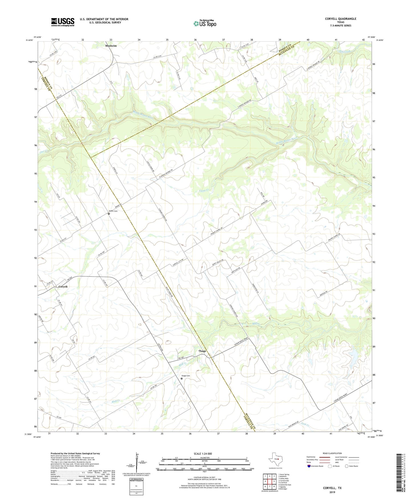
2022 topographic map quadrangle Coryell in the state of Texas. Scale: 1:24000. Based on the newly updated USGS 7.5' US Topo map series, this map is in the following counties: McLennan, Coryell, Bosque. The map contains contour data, water features, and other items you are used to seeing on USGS maps, but also has updated roads and other features. This is the next generation of topographic maps. Printed on high-quality waterproof paper with UV fade-resistant inks.
Quads adjacent to this one:
West: Turnersville
Northwest: Hurst Spring
North: Mosheim
Northeast: Valley Mills
East: Crawford
Southeast: McGregor
South: Oglesby
Southwest: Gatesville East
This map covers the same area as the classic USGS quad with code o31097e5.
Contains the following named places: Calvary Church, Cannan Church, Castle Creek, Cave Creek, Coryell, Flying ND Ranch Airport, Osage, Osage Cemetery, Osage School, Prairie Chapel School, Rainey Creek, Sadler Cemetery, Saint Johns Church