MyTopo
Mount Enterprise Texas US Topo Map
Couldn't load pickup availability
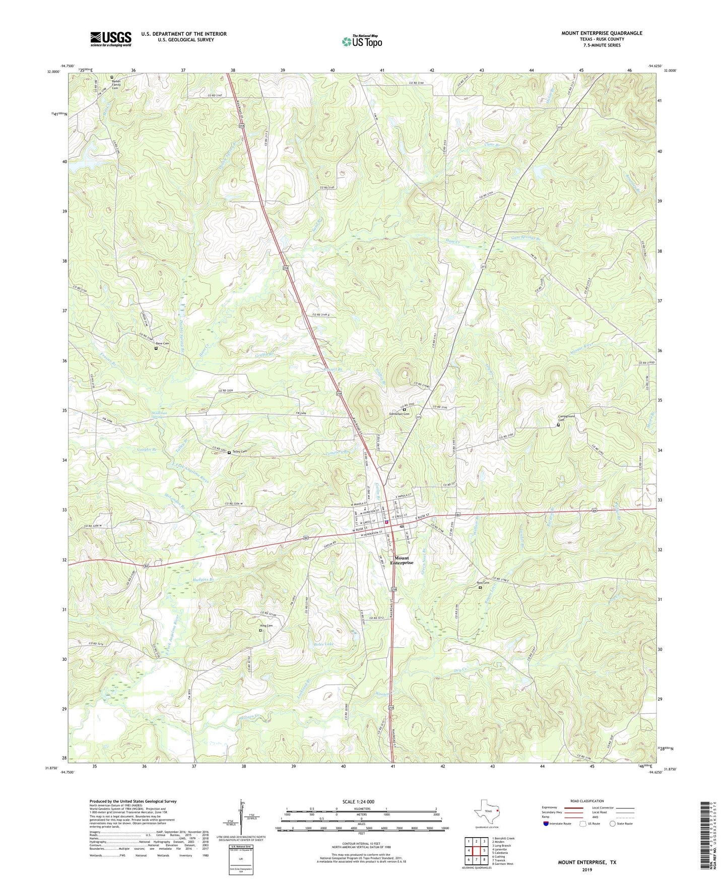
2019 topographic map quadrangle Mount Enterprise in the state of Texas. Scale: 1:24000. Based on the newly updated USGS 7.5' US Topo map series, this map is in the following counties: Rusk. The map contains contour data, water features, and other items you are used to seeing on USGS maps, but also has updated roads and other features. This is the next generation of topographic maps. Printed on high-quality waterproof paper with UV fade-resistant inks.
Quads adjacent to this one:
West: Laneville
Northwest: Berryhill Creek
North: Minden
Northeast: Long Branch
East: Caledonia
Southeast: Garrison West
South: Trawick
Southwest: Cushing
Contains the following named places: Bane Cemetery, Barker Family Cemetery, Bayou Loco, Boles Lake, Burgess Branch, Campground Cemetery, Cemetery Branch, City of Mount Enterprise, Clear Branch, Double Spring Branch, Dry Creek, Edmonson Cemetery, Frasier Branch, Gatlin Branch, Gentry Branch, Green Neal Branch, Griffin Branch, Griffin Lake Dam, Gum Springs Branch, Ham Creek, Hudgins Branch, Jones Lake, King Cemetery, Lawler Branch, Lockland Branch, Lone Star Church, Longview Public Library, McLendon Branch, Minden Elementary and High School, Mount Enterprise, Mount Enterprise City Hall, Mount Enterprise Police Department, Mount Enterprise Post Office, Mount Enterprise Volunteer Fire Department, Parker Branch, Ross Cemetery, Russell Branch, Sand Branch, Schoolhouse Branch, Shiloh Branch, Shiloh Church, Stockman Spring, Talley Branch, Talley Cemetery, Vaughn Branch, Wallace Branch, Wooten Creek, ZIP Code: 75681