MyTopo
Berryhill Creek Texas US Topo Map
Couldn't load pickup availability
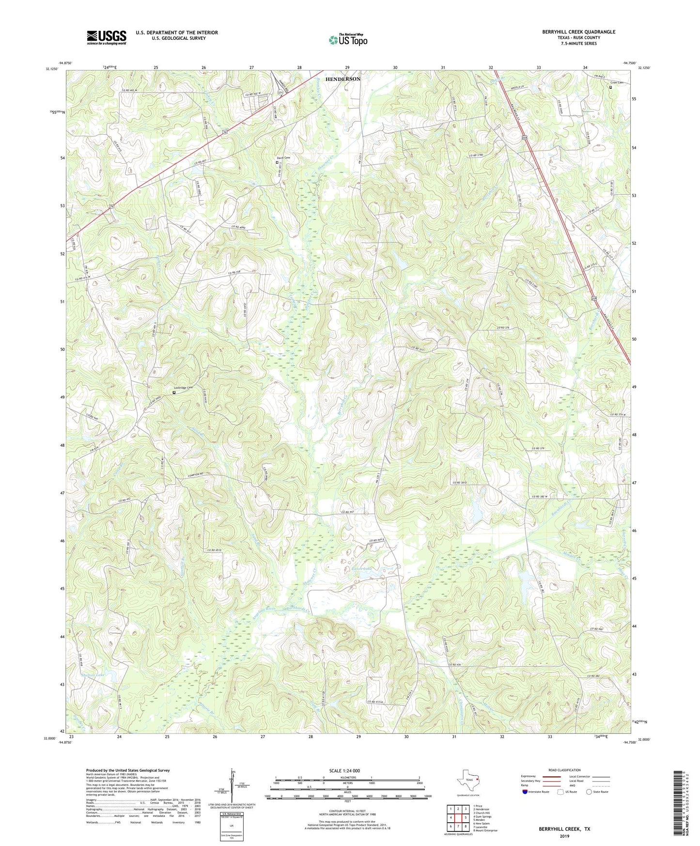
2022 topographic map quadrangle Berryhill Creek in the state of Texas. Scale: 1:24000. Based on the newly updated USGS 7.5' US Topo map series, this map is in the following counties: Rusk. The map contains contour data, water features, and other items you are used to seeing on USGS maps, but also has updated roads and other features. This is the next generation of topographic maps. Printed on high-quality waterproof paper with UV fade-resistant inks.
Quads adjacent to this one:
West: Gum Springs
Northwest: Price
North: Henderson
Northeast: Church Hill
East: Minden
Southeast: Mount Enterprise
South: Laneville
Southwest: New Salem
This map covers the same area as the classic USGS quad with code o32094a7.
Contains the following named places: Barnhardt Creek, Berryhill Creek, Bethel Cemetery, Bethel Church, Bethel Creek, Bromley Creek, Chinquapin Creek, Crow Cemetery, Davis Cemetery, Eaton Lake, Eaton Lake Dam, Ebenezer Church, Good Hope Church, Gum Branch, Hays Creek, Hickey, J A Morris Dam, Jarrell Creek, KJMD-AM (Laneville), Laneville Church, Lockridge Cemetery, Mill Creek, Minden Creek, Mission Springs Church, Morris Lake, Morris Lake Dam, Mount Olive Church, Parker Creek, Prairie Branch, Rusk County, Sand Branch, Shawnee Creek, Shelton Lake, Shelton Lake Dam, Turkey Creek, Union Grove Church, Walker Branch, Youngblood Dam, ZIP Code: 75654