MyTopo
Cushing Texas US Topo Map
Couldn't load pickup availability
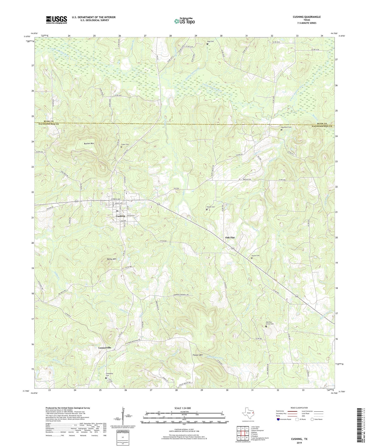
2022 topographic map quadrangle Cushing in the state of Texas. Scale: 1:24000. Based on the newly updated USGS 7.5' US Topo map series, this map is in the following counties: Nacogdoches, Rusk. The map contains contour data, water features, and other items you are used to seeing on USGS maps, but also has updated roads and other features. This is the next generation of topographic maps. Printed on high-quality waterproof paper with UV fade-resistant inks.
Quads adjacent to this one:
West: Reklaw
Northwest: New Salem
North: Laneville
Northeast: Mount Enterprise
East: Trawick
Southeast: Nacogdoches North
South: Lake Nacogdoches North
Southwest: Douglass
This map covers the same area as the classic USGS quad with code o31094g7.
Contains the following named places: Beech Creek, Big Rock Church, Blackburn Cemetery, Button Mountain, City of Cushing, Cushing, Cushing City Hall, Cushing Lookout Tower, Cushing Post Office, Denny Mountain, Dill Creek, Everett Branch, Fenton Cemetery, Flower Mountain, Friendship Cemetery, Fuller Cemetery, God-in-Christ Church, Happy Valley, Ike Owens Branch, Jones Creek, Kipp Cemetery, Little Creek, Looneyville, Midway Church, Oak Flat, Old Pine Grove Cemetery, Owens - Nelson Cemetery, Reagan Branch, Shady Grove Church, Sulphur Springs Branch, Tranwick Gas Field, Zion Grove, ZIP Code: 75760