MyTopo
Mountain Home Texas US Topo Map
Couldn't load pickup availability
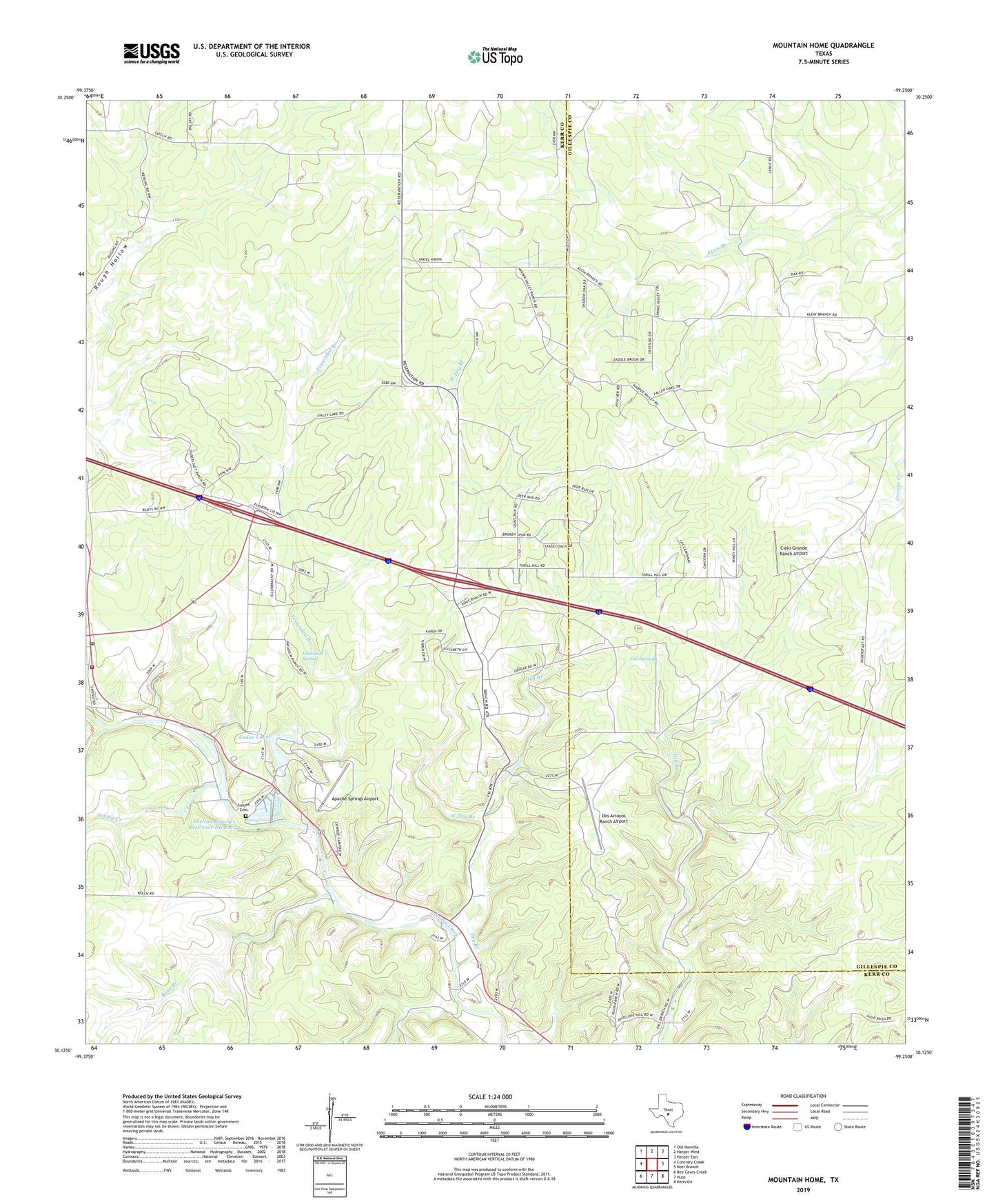
2019 topographic map quadrangle Mountain Home in the state of Texas. Scale: 1:24000. Based on the newly updated USGS 7.5' US Topo map series, this map is in the following counties: Kerr, Gillespie. The map contains contour data, water features, and other items you are used to seeing on USGS maps, but also has updated roads and other features. This is the next generation of topographic maps. Printed on high-quality waterproof paper with UV fade-resistant inks.
Quads adjacent to this one:
West: Contrary Creek
Northwest: Old Noxville
North: Harper West
Northeast: Harper East
East: Nott Branch
Southeast: Kerrville
South: Hunt
Southwest: Bee Caves Creek
Contains the following named places: Apache Springs Airport, Byas Branch, Cedar Lake, Cedar Lake Dam, Cielo Grande Ranch Airport, Contrary Creek, Dos Arroyos Ranch Airport, Dry Branch, Ellebracht Springs, Fall Springs, Fessenden Branch, Mountain Home Post Office, Mountain Home Volunteer Fire Department, Riata Ranch Airport, Shelton Ranches Reservoir Number 2, Shelton Ranches Reservoir Number 2 Dam, Spring Creek, Sunset Cemetery, Sunset Church, Tecaboca Camp, West Dry Branch, ZIP Code: 78029