MyTopo
Contrary Creek Texas US Topo Map
Couldn't load pickup availability
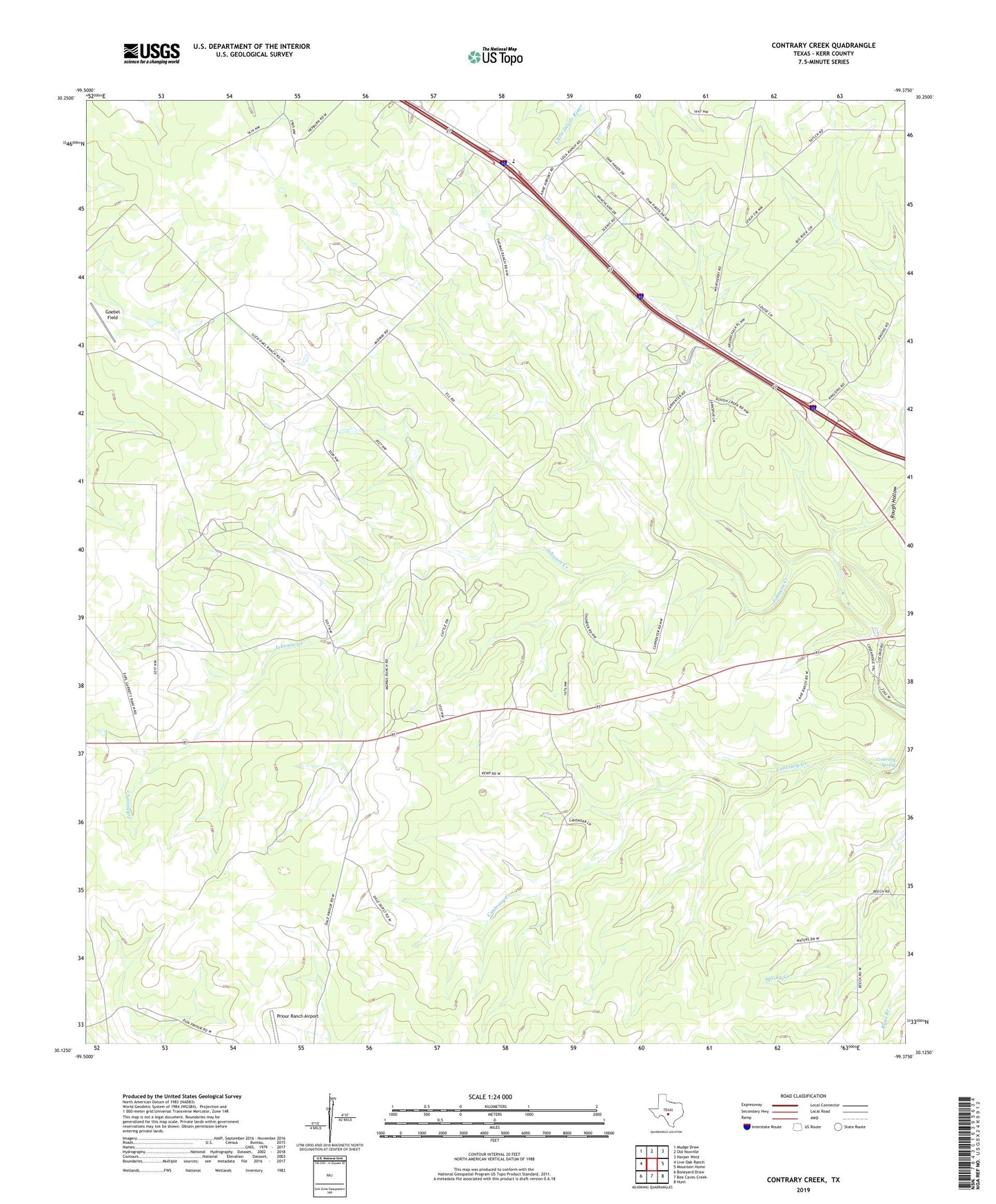
2022 topographic map quadrangle Contrary Creek in the state of Texas. Scale: 1:24000. Based on the newly updated USGS 7.5' US Topo map series, this map is in the following counties: Kerr. The map contains contour data, water features, and other items you are used to seeing on USGS maps, but also has updated roads and other features. This is the next generation of topographic maps. Printed on high-quality waterproof paper with UV fade-resistant inks.
Quads adjacent to this one:
West: Live Oak Ranch
Northwest: Mudge Draw
North: Old Noxville
Northeast: Harper West
East: Mountain Home
Southeast: Hunt
South: Bee Caves Creek
Southwest: Boneyard Draw
This map covers the same area as the classic USGS quad with code o30099b4.
Contains the following named places: Contrary Spring, East Windmill, Goebel Field, Midway Station, Mountain Home, New Windmill, Rough Hollow