MyTopo
Navasota Texas US Topo Map
Couldn't load pickup availability
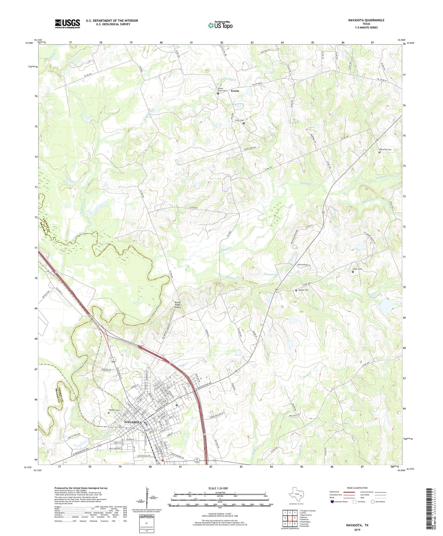
2019 topographic map quadrangle Navasota in the state of Texas. Scale: 1:24000. Based on the newly updated USGS 7.5' US Topo map series, this map is in the following counties: Grimes, Brazos. The map contains contour data, water features, and other items you are used to seeing on USGS maps, but also has updated roads and other features. This is the next generation of topographic maps. Printed on high-quality waterproof paper with UV fade-resistant inks.
Quads adjacent to this one:
West: Millican
Northwest: Ferguson Crossing
North: Carlos
Northeast: Roans Prairie
East: Anderson
Southeast: Stoneham
South: Courtney
Southwest: Washington
Contains the following named places: Berryman Cemetery, Bridle Ridge Airport, Cedar Creek, CHI Saint Joseph Health Grimes Hospital, City of Navasota, Erwin, Erwin Cemetery, Foster House, Holland Creek, Honey Creek, John C Webb Elementary School, KNAV-FM (Navasota), KWBC-AM (Navasota), Navasota, Navasota City Hall, Navasota Commercial Historic District, Navasota Intermediate School, Navasota Police Department, Navasota Post Office, Navasota Primary School, Navasota Regional Hospital Heliport, Navasota Volunteer Fire Department, Neblett Cemetery, Oakland Cemetery, Odd Fellows Cemetery, P A Smith Hotel, Prescott Lake, Prescott Lake Dam, Saint John Church, Salem Cemetery, Salem Church, Salem Missionary Church, Spring Creek, Steele Grove Cemetery, Steele House, Thomas Creek, Turkey Creek