MyTopo
Courtney Texas US Topo Map
Couldn't load pickup availability
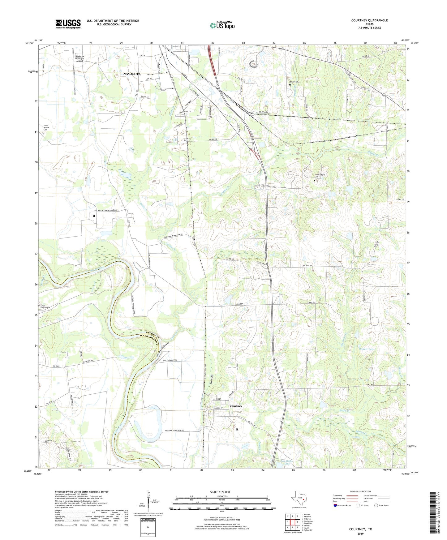
2022 topographic map quadrangle Courtney in the state of Texas. Scale: 1:24000. Based on the newly updated USGS 7.5' US Topo map series, this map is in the following counties: Grimes, Washington. The map contains contour data, water features, and other items you are used to seeing on USGS maps, but also has updated roads and other features. This is the next generation of topographic maps. Printed on high-quality waterproof paper with UV fade-resistant inks.
Quads adjacent to this one:
West: Washington
Northwest: Millican
North: Navasota
Northeast: Anderson
East: Stoneham
Southeast: Waller NW
South: Howth
Southwest: Daniels
This map covers the same area as the classic USGS quad with code o30096c1.
Contains the following named places: Binford Park, Bryant Branch, Bryant Cemetery, Courtney, Elm Grove Creek, Evans Prairie Cemetery, Grassy Creek, Grimes County Constable's Office Precinct 3, Los Robles Lake Dam, Lynn Grove, Mercy Seat Church, Navasota Municipal Airport, Rocky Creek, Saint Paul Church, Sand Prairie Cemetery, Sandy Creek, Sommerford Cemetery, Texas Department of Criminal Justice O L Luther Unit, Texas Department of Criminal Justice Wallace Pack Unit, Weaver Lake, Weaver Lake Dam, West Academy, Wood, ZIP Code: 77868