MyTopo
New Hope Texas US Topo Map
Couldn't load pickup availability
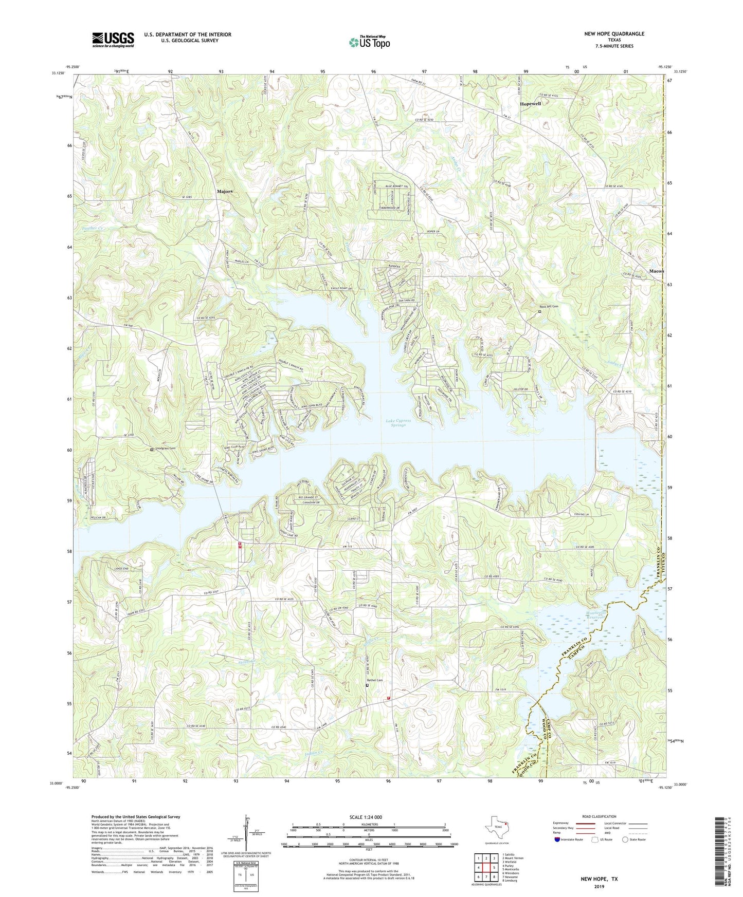
2019 topographic map quadrangle New Hope in the state of Texas. Scale: 1:24000. Based on the newly updated USGS 7.5' US Topo map series, this map is in the following counties: Franklin, Camp, Titus, Wood. The map contains contour data, water features, and other items you are used to seeing on USGS maps, but also has updated roads and other features. This is the next generation of topographic maps. Printed on high-quality waterproof paper with UV fade-resistant inks.
Quads adjacent to this one:
West: Purley
Northwest: Saltillo
North: Mount Vernon
Northeast: Winfield
East: Monticello
Southeast: Leesburg
South: Newsome
Southwest: Winnsboro
Contains the following named places: Andys Creek, Bethel Cemetery, Clopton Road Church, Cypress Creek Park, Franklin County Dam, Frog Creek, Good Hope Church, Hopewell, KPXI-FM (Mount Pleasant), Lake Cypress Springs, Mac Kay Heliport, Macon, Macon Church, Majors, Mary King Park, New Hope, New Hope Oil Field, Over Look Park, Panther Creek, Prairie Branch, Rock Hill Cemetery, Rogers-Drummond House, Snodgrass Cemetery, South Franklin County Volunteer Fire Department, South Franklin CSD Number 20 School, South Franklin Volunteer Fire Department Station 1, South Franklin Volunteer Fire Department Station 2, Stouts Creek, Tidewater Camp, Walleye Park, Winnsboro Division, ZIP Code: 75480