MyTopo
Mount Vernon Texas US Topo Map
Couldn't load pickup availability
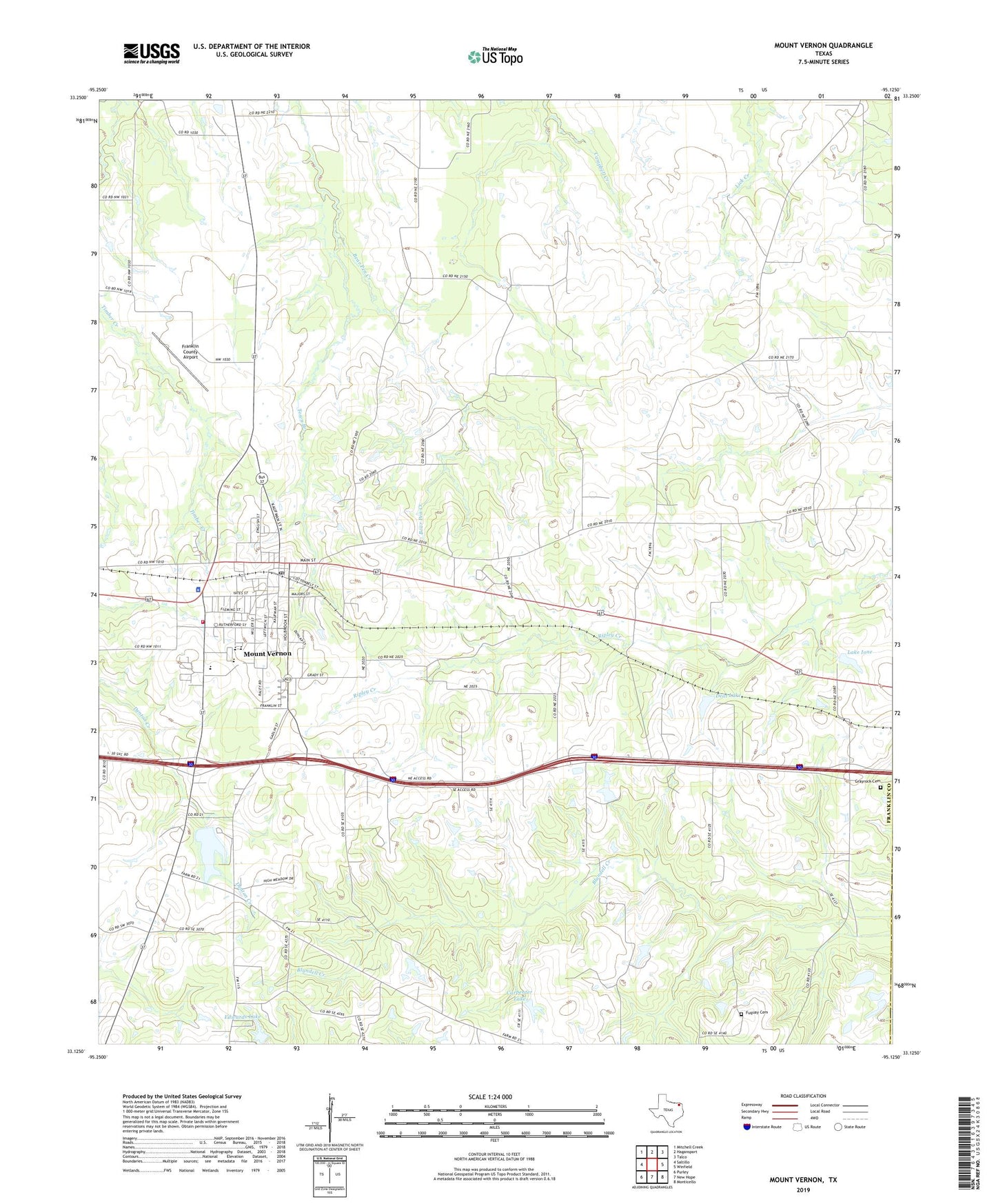
2022 topographic map quadrangle Mount Vernon in the state of Texas. Scale: 1:24000. Based on the newly updated USGS 7.5' US Topo map series, this map is in the following counties: Franklin, Titus. The map contains contour data, water features, and other items you are used to seeing on USGS maps, but also has updated roads and other features. This is the next generation of topographic maps. Printed on high-quality waterproof paper with UV fade-resistant inks.
Quads adjacent to this one:
West: Saltillo
Northwest: Mitchell Creek
North: Hagansport
Northeast: Talco
East: Winfield
Southeast: Monticello
South: New Hope
Southwest: Purley
This map covers the same area as the classic USGS quad with code o33095b2.
Contains the following named places: Carpenter Lake, Carpenter Lake Dam, Church of Christ, Deal Lake, Deal Lake Dam, Denton Church, Denton School, East Texas Medical Center, Edwards Lake, Edwards Lake Dam, Franklin County, Franklin County Airport, Franklin County Constable's Office Precinct 1, Franklin County Jail, Franklin County Sheriff's Office, Friendship Church, Fuquay Cemetery, Glade Springs Church, Grace Baptist Church, Grayrock Cemetery, Lake Ione, Lake Ione Dam, Mount Vernon, Mount Vernon Church of God in Christ, Mount Vernon City Dam, Mount Vernon City Hall, Mount Vernon Division, Mount Vernon Elementary School, Mount Vernon Fire Department, Mount Vernon High School, Mount Vernon Intermediate School, Mount Vernon Junior High School, Mount Vernon Medical Center Heliport, Mount Vernon Municipal Reservoir, Mount Vernon Police Department, Mount Vernon Post Office, Prairie Grove Church, Providence Church, Ripley Creek Church, Town Branch, Town of Mount Vernon, ZIP Code: 75457