
MyTopo
Odds Texas US Topo Map
Couldn't load pickup availability
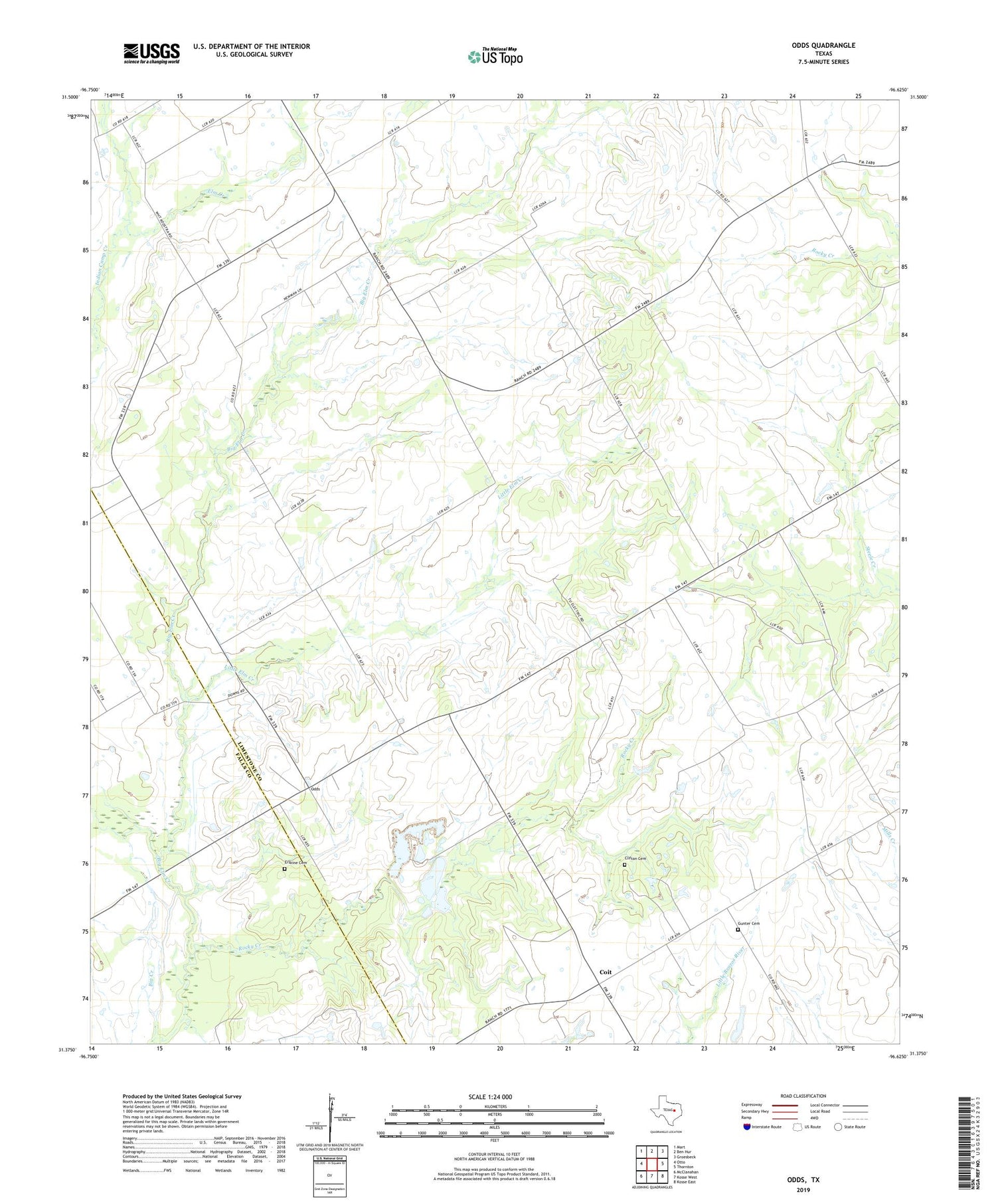
2019 topographic map quadrangle Odds in the state of Texas. Scale: 1:24000. Based on the newly updated USGS 7.5' US Topo map series, this map is in the following counties: Limestone, Falls. The map contains contour data, water features, and other items you are used to seeing on USGS maps, but also has updated roads and other features. This is the next generation of topographic maps. Printed on high-quality waterproof paper with UV fade-resistant inks.
Quads adjacent to this one:
West: Otto
Northwest: Mart
North: Ben Hur
Northeast: Groesbeck
East: Thornton
Southeast: Kosse East
South: Kosse West
Southwest: McClanahan
Contains the following named places: Big Elm Creek, Big Hill, Buffalo Mop, Clifton Cemetery, Coit, Elm Creek, Erskine Cemetery, Fairview Church, Gunter Cemetery, Indian Camp Creek, Little Elm, Little Elm Creek, Locust Grove Church, Odds, Pleasant Grove, Rocky Creek


