MyTopo
Otto Texas US Topo Map
Couldn't load pickup availability
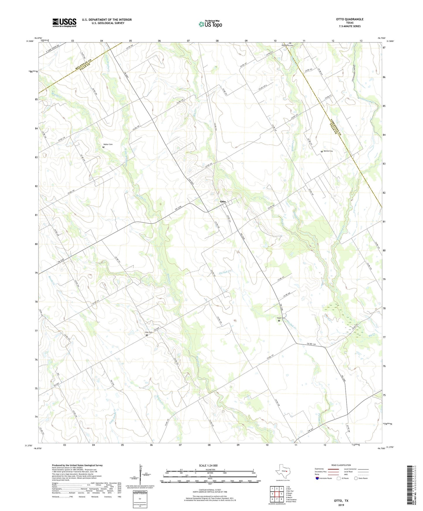
2022 topographic map quadrangle Otto in the state of Texas. Scale: 1:24000. Based on the newly updated USGS 7.5' US Topo map series, this map is in the following counties: Falls, Limestone, McLennan. The map contains contour data, water features, and other items you are used to seeing on USGS maps, but also has updated roads and other features. This is the next generation of topographic maps. Printed on high-quality waterproof paper with UV fade-resistant inks.
Quads adjacent to this one:
West: Riesel
Northwest: Elk
North: Mart
Northeast: Ben Hur
East: Odds
Southeast: Kosse West
South: McClanahan
Southwest: Marlin
This map covers the same area as the classic USGS quad with code o31096d7.
Contains the following named places: Brushy Bluff Church, Corner School, Cottonwood Creek, Criswell Church, Eureka School, Hogpen Creek, Hope Cemetery, Little Brushy Creek, Metina Cemetery, Oklahoma Cemetery, Otto, Perry Division, Saint Johns Church, Walker Cemetery, Zion Cemetery