MyTopo
McClanahan Texas US Topo Map
Couldn't load pickup availability
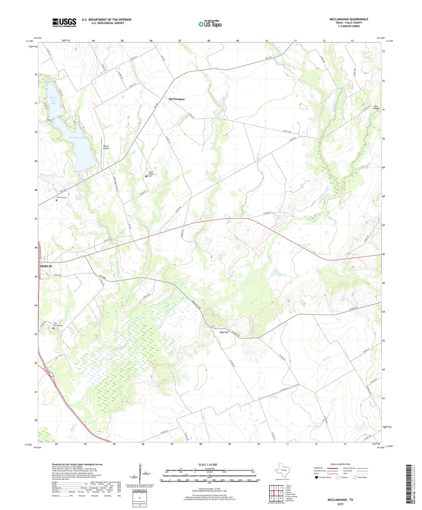
2022 topographic map quadrangle McClanahan in the state of Texas. Scale: 1:24000. Based on the newly updated USGS 7.5' US Topo map series, this map is in the following counties: Falls. The map contains contour data, water features, and other items you are used to seeing on USGS maps, but also has updated roads and other features. This is the next generation of topographic maps. Printed on high-quality waterproof paper with UV fade-resistant inks.
Quads adjacent to this one:
West: Marlin
Northwest: Riesel
North: Otto
Northeast: Odds
East: Kosse West
Southeast: Bremond
South: Reagan
Southwest: Cedar Springs
This map covers the same area as the classic USGS quad with code o31096c7.
Contains the following named places: Bald Hill, Bell Bridge, Big Sandy Creek, Brushy Creek, Cedar Creek, City Lake, Elm Creek, Falls County Cemetery, Hillcrest Cemetery, Keechi Creek, Little Sandy Creek, Marlin Airport, Marlin City Lake, Marlin Division, Marlin Old City Lake Dam, Marvin Allen Church, McClanahan, New City Lake, New Marlin Reservoir Dam, Pin Oak Creek, Shady Grove Church, Springhill Church, Sunrise, Taylor Chapel Cemetery, ZIP Code: 76661