MyTopo
O'Donnell Texas US Topo Map
Couldn't load pickup availability
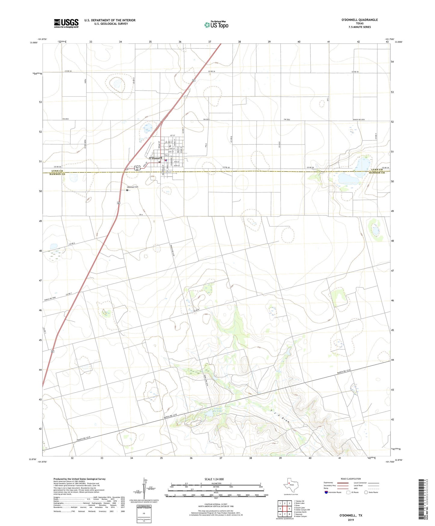
2022 topographic map quadrangle O'Donnell in the state of Texas. Scale: 1:24000. Based on the newly updated USGS 7.5' US Topo map series, this map is in the following counties: Dawson, Lynn. The map contains contour data, water features, and other items you are used to seeing on USGS maps, but also has updated roads and other features. This is the next generation of topographic maps. Printed on high-quality waterproof paper with UV fade-resistant inks.
Quads adjacent to this one:
West: Gooch Lake
Northwest: Tahoka SW
North: Skeen Lake
Northeast: Draw
East: Indian Canyon NW
Southeast: Indian Canyon
South: Hancock
Southwest: Lamesa North
This map covers the same area as the classic USGS quad with code o32101h7.
Contains the following named places: Caprock Ranch, City of O'Donnell, Gravel Pit Lake, Gravel Pit Lake Dam, O'Donnell, ODonnell Cemetery, O'Donnell City Hall, O'Donnell High School, O'Donnell Junior High School, O'Donnell Police Department, O'Donnell Post Office, O'Donnell Volunteer Fire Department, ZIP Code: 79351