MyTopo
Ola Texas US Topo Map
Couldn't load pickup availability
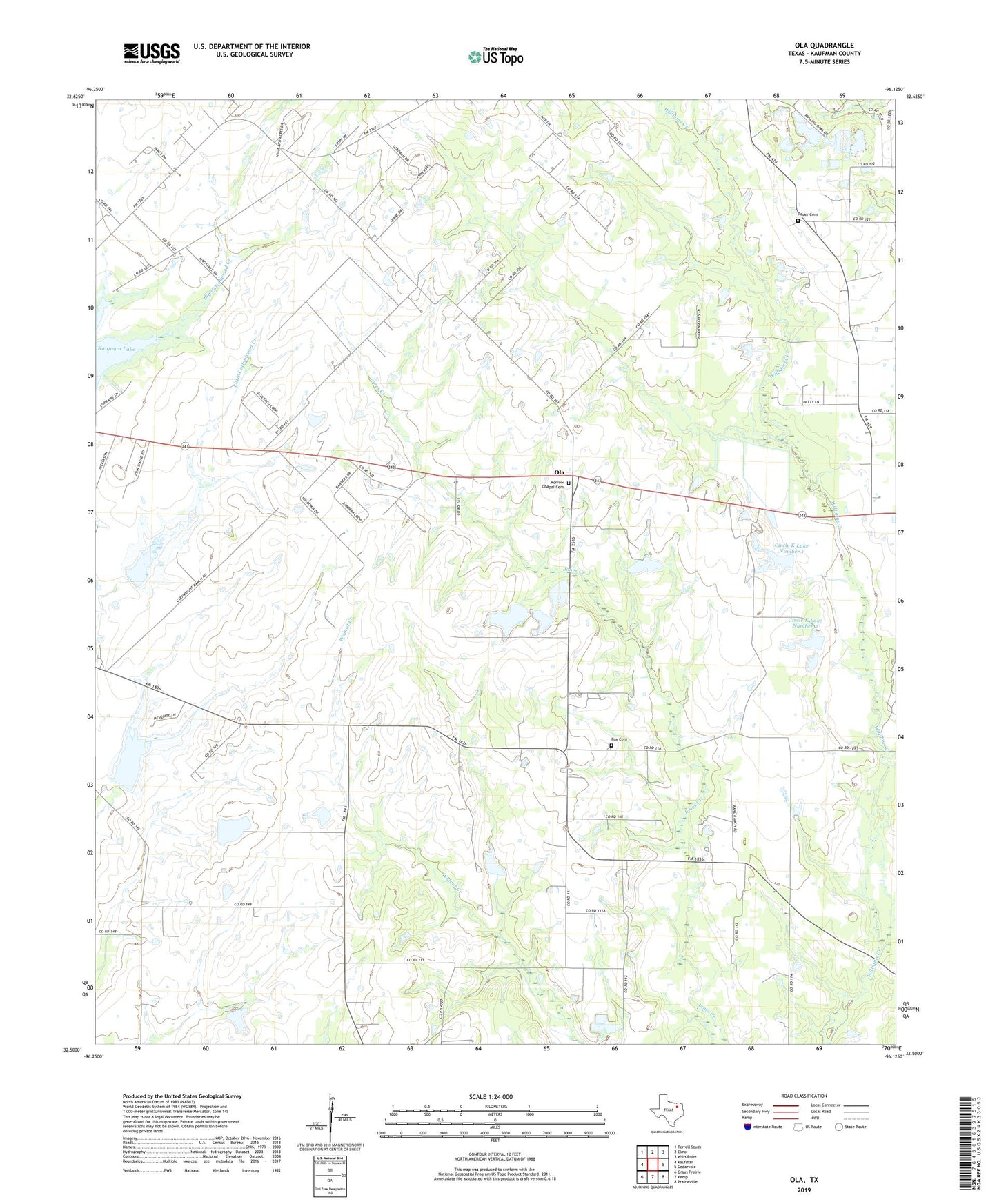
2019 topographic map quadrangle Ola in the state of Texas. Scale: 1:24000. Based on the newly updated USGS 7.5' US Topo map series, this map is in the following counties: Kaufman. The map contains contour data, water features, and other items you are used to seeing on USGS maps, but also has updated roads and other features. This is the next generation of topographic maps. Printed on high-quality waterproof paper with UV fade-resistant inks.
Quads adjacent to this one:
West: Kaufman
Northwest: Terrell South
North: Elmo
Northeast: Wills Point
East: Cedarvale
Southeast: Prairieville
South: Kemp
Southwest: Grays Prairie
Contains the following named places: Ayers Chapel, Cedar Hill Church, Circle K Dam Number 1, Circle K Dam Number 2, Circle K Lake Number 1, Circle K Lake Number 2, Dam Number 76, Dam Number 77, Fair Oil Field, Flat Rock Church, Fox Cemetery, Hall Airport, Morrow Chapel Cemetery, Ola, Rader Cemetery, Rand, Red Oak Church, Soil Conservation Service Site 76 Dam, Soil Conservation Service Site 76 Reservoir, Soil Conservation Service Site 77a Dam, Soil Conservation Service Site 77a Reservoir, Terrell South Division, West Lake, West Lake Dam