MyTopo
Grays Prairie Texas US Topo Map
Couldn't load pickup availability
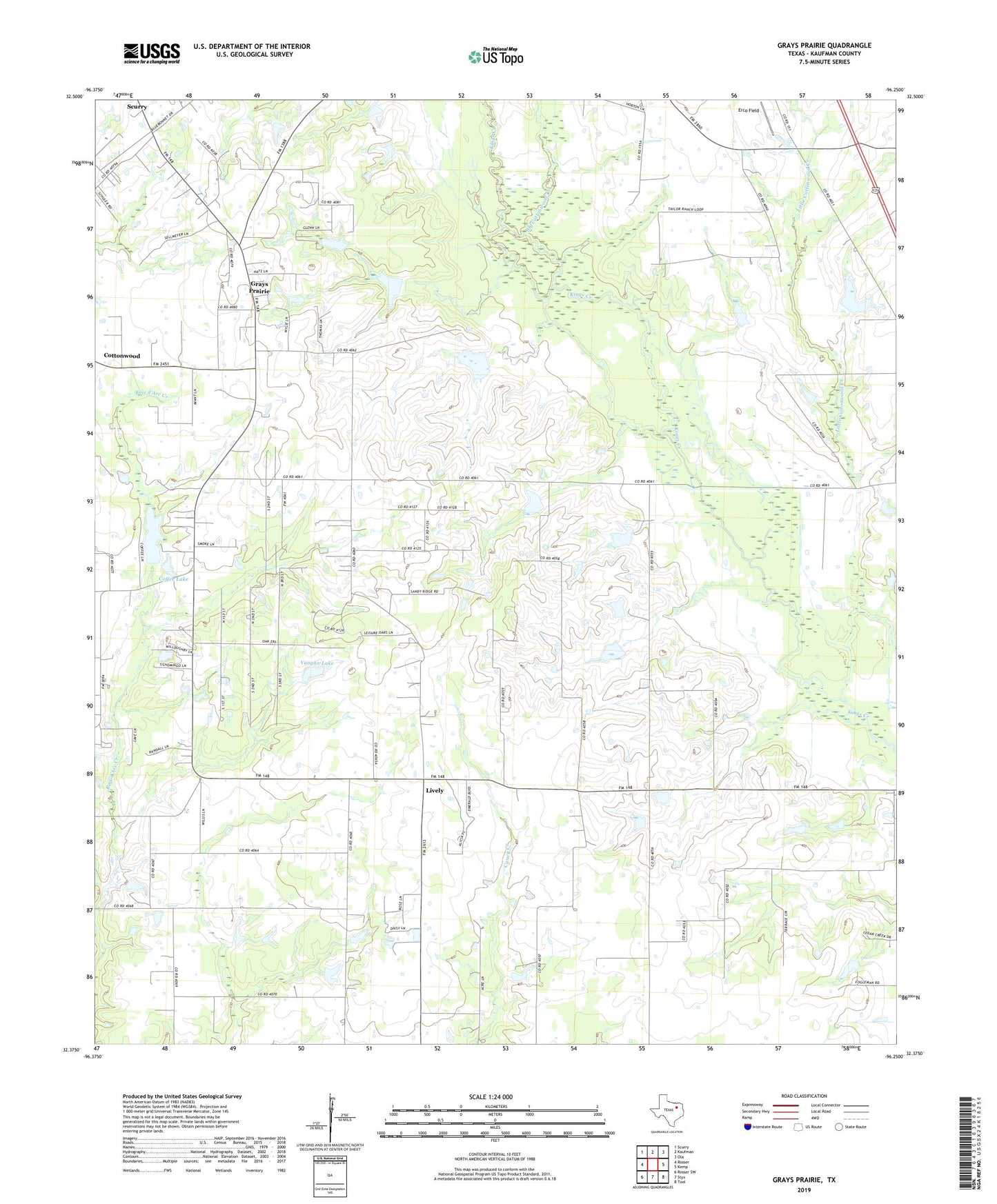
2022 topographic map quadrangle Grays Prairie in the state of Texas. Scale: 1:24000. Based on the newly updated USGS 7.5' US Topo map series, this map is in the following counties: Kaufman. The map contains contour data, water features, and other items you are used to seeing on USGS maps, but also has updated roads and other features. This is the next generation of topographic maps. Printed on high-quality waterproof paper with UV fade-resistant inks.
Quads adjacent to this one:
West: Rosser
Northwest: Scurry
North: Kaufman
Northeast: Ola
East: Kemp
Southeast: Tool
South: Styx
Southwest: Rosser SW
This map covers the same area as the classic USGS quad with code o32096d3.
Contains the following named places: Big Cottonwood Creek, Coffee Lake, Coffee Lake Dam, Erco Field, Grays Prairie, Grays Prairie City Hall, Kaufman Division, Little Cottonwood Creek, Lively, Shady Grove Church, Shilo Church, Soil Conservation Service Site 68 Dam, Soil Conservation Service Site 68 Reservoir, Soil Conservation Service Site 69 Dam, Soil Conservation Service Site 69 Reservoir, Soil Conservation Service Site 70 Dam, Soil Conservation Service Site 70 Reservoir, Soil Conservation Service Site 71 Dam, Soil Conservation Service Site 71 Reservoir, Soil Conservation Service Site 83 Dam, Soil Conservation Service Site 83 Reservoir, Soil Conservation Service Site 84 Dam, Soil Conservation Service Site 84 Reservoir, Stubbs, Vaughn Lake, Vaughn Lake Dam, Village of Grays Prairie, Wells Dam, Wells Lake