MyTopo
Prairieville Texas US Topo Map
Couldn't load pickup availability
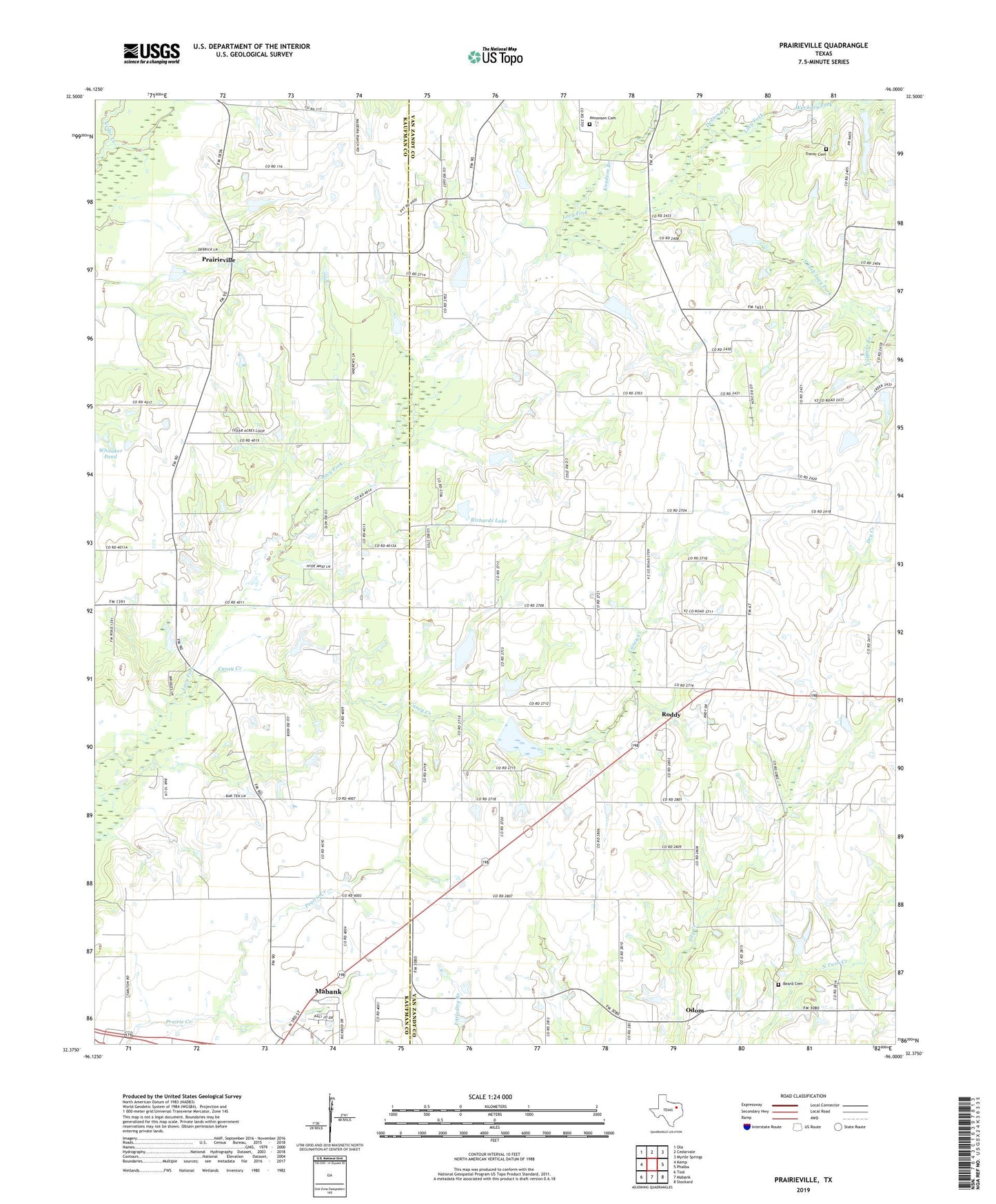
2022 topographic map quadrangle Prairieville in the state of Texas. Scale: 1:24000. Based on the newly updated USGS 7.5' US Topo map series, this map is in the following counties: Van Zandt, Kaufman. The map contains contour data, water features, and other items you are used to seeing on USGS maps, but also has updated roads and other features. This is the next generation of topographic maps. Printed on high-quality waterproof paper with UV fade-resistant inks.
Quads adjacent to this one:
West: Kemp
Northwest: Ola
North: Cedarvale
Northeast: Myrtle Springs
East: Phalba
Southeast: Stockard
South: Mabank
Southwest: Tool
This map covers the same area as the classic USGS quad with code o32096d1.
Contains the following named places: Aanonsen Cemetery, Beard Cemetery, Caney Creek, Coppers Branch, Denton Creek, Dry Lacy Fork, Elm Grove Church, Four Mile Prairie, Fourmile Church, Knudson Branch, Manning Airport, Odom, Prairieville, Richards Lake, Richards Lake Dam, Roddy, Soil Conservation Service Site 120 Dam, Soil Conservation Service Site 120 Reservoir, Soil Conservation Service Site 121a Dam, Soil Conservation Service Site 121a Reservoir, Soil Conservation Service Site 130a Dam, Soil Conservation Service Site 130a Reservoir, Soil Conservation Service Site 130b Dam, Soil Conservation Service Site 130b Reservoir, Soil Conservation Service Site 131 Dam, Soil Conservation Service Site 131 Reservoir, Soil Conservation Service Site 135a Dam, Soil Conservation Service Site 135a Reservoir, Soil Conservation Service Site 135c Dam, Soil Conservation Service Site 135c Reservoir, Soil Conservation Service Site 136 Dam, Soil Conservation Service Site 136 Reservoir, Soil Conservation Service Site 137 Dam, Soil Conservation Service Site 137 Reservoir, Soil Conservation Service Site 138 Dam, Soil Conservation Service Site 138 Reservoir, Soil Conservation Service Site 139 Dam, Soil Conservation Service Site 139 Reservoir, Soil Conservation Service Site 140 Dam, Soil Conservation Service Site 140 Reservoir, South Fork Lacy Fork, Traver Cemetery, Wet Lacy Fork, Whitaker Pond, White Hall Community Center, ZIP Code: 75147