MyTopo
Kemp Texas US Topo Map
Couldn't load pickup availability
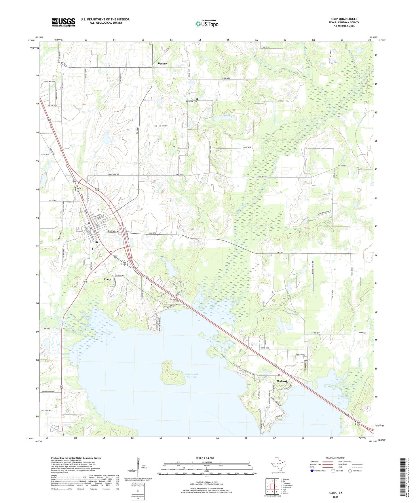
2022 topographic map quadrangle Kemp in the state of Texas. Scale: 1:24000. Based on the newly updated USGS 7.5' US Topo map series, this map is in the following counties: Kaufman. The map contains contour data, water features, and other items you are used to seeing on USGS maps, but also has updated roads and other features. This is the next generation of topographic maps. Printed on high-quality waterproof paper with UV fade-resistant inks.
Quads adjacent to this one:
West: Grays Prairie
Northwest: Kaufman
North: Ola
Northeast: Cedarvale
East: Prairieville
Southeast: Mabank
South: Tool
Southwest: Styx
This map covers the same area as the classic USGS quad with code o33096g3.
Contains the following named places: Becker, Cedar Creek Lake Division, Cedar Creek Wildlife Management Area - Big Island Unit, City of Kemp, East Texas Medical Center Emergency Medical Service Kemp, Gossett Church, Ham-Gossett Oil Field, Jones Creek, Kemp, Kemp Cemetery, Kemp Church of Christ, Kemp City Hall, Kemp Dam, Kemp Junior High School, Kemp Lake, Kemp Police Department, Kemp Post Office, Kemp Primary School, Kemp Volunteer Fire Department, Kemp-Mabank Division, Kings Creek, Lone Oak Cemetery, Nolan Lake, Nolan Lake Dam, Soil Conservation Service Site 85 Dam, Soil Conservation Service Site 85 Reservoir, Walnut Creek, Williams Creek, Yellow Jacket Stadium