MyTopo
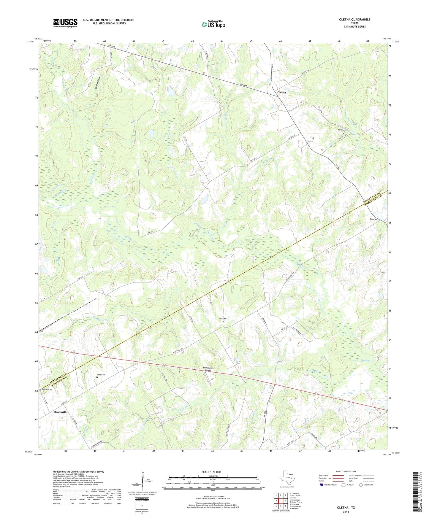
Oletha Texas US Topo Map
Couldn't load pickup availability
2019 topographic map quadrangle Oletha in the state of Texas. Scale: 1:24000. Based on the newly updated USGS 7.5' US Topo map series, this map is in the following counties: Limestone, Robertson. The map contains contour data, water features, and other items you are used to seeing on USGS maps, but also has updated roads and other features. This is the next generation of topographic maps. Printed on high-quality waterproof paper with UV fade-resistant inks.
Quads adjacent to this one:
West: Kosse East
Northwest: Thornton
North: Box Church
Northeast: Farrar
East: Round Prairie
Southeast: Marquez
South: Bald Prairie
Southwest: Petteway
Contains the following named places: Cox Creek, Davis Creek, Ebenezer Cemetery, Ferguson Cemetery, Head Cemetery, Heads Creek, Headsville, Oletha, Owens Creek, Pace Cemetery, Pin Oak Creek, Polecat Creek, RMR Ranch Airport, Sand Branch, Thompson Cemetery, White Branch, Willow Creek, Wolf Hollow, ZIP Code: 76687