MyTopo
Bald Prairie Texas US Topo Map
Couldn't load pickup availability
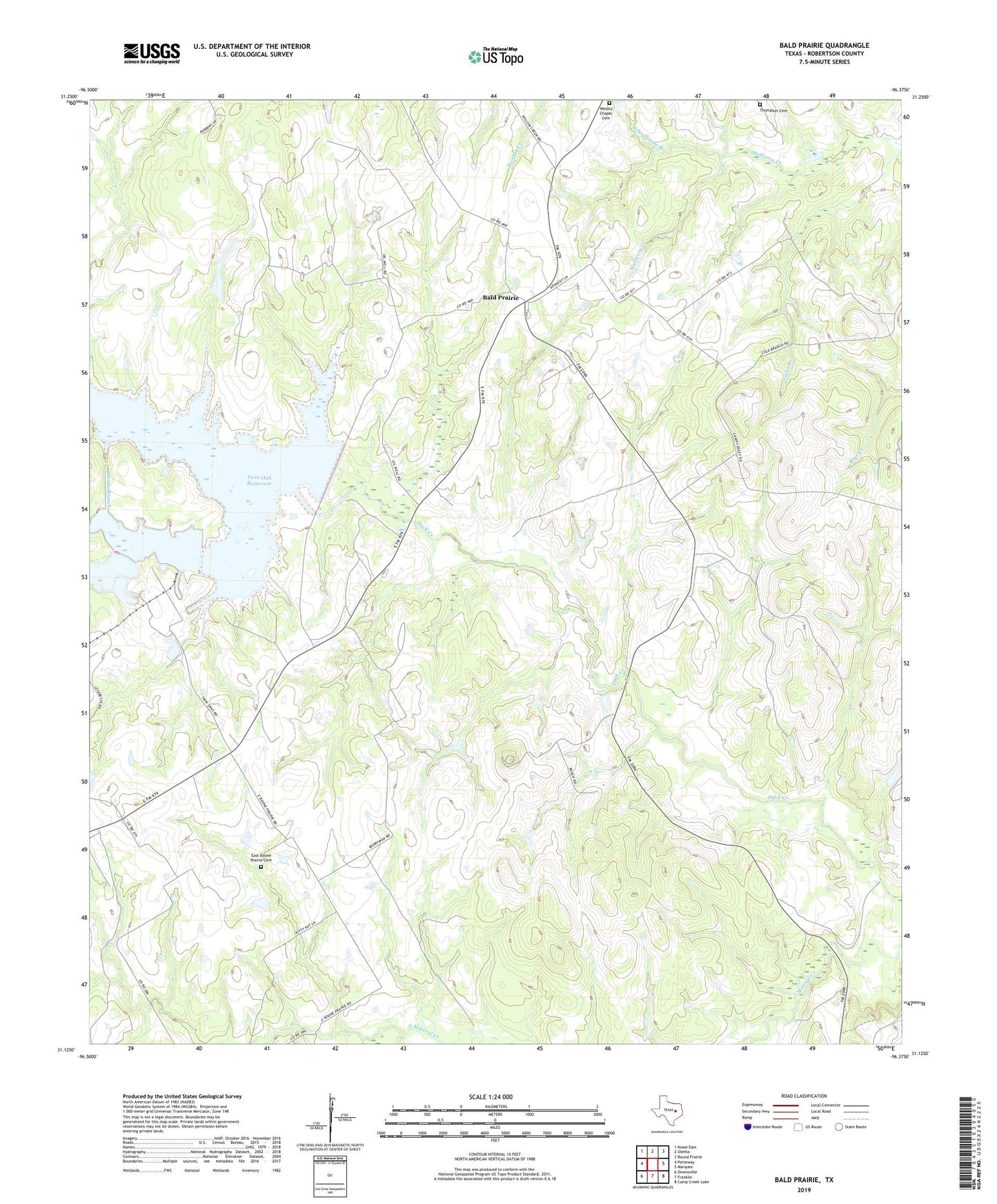
2022 topographic map quadrangle Bald Prairie in the state of Texas. Scale: 1:24000. Based on the newly updated USGS 7.5' US Topo map series, this map is in the following counties: Robertson. The map contains contour data, water features, and other items you are used to seeing on USGS maps, but also has updated roads and other features. This is the next generation of topographic maps. Printed on high-quality waterproof paper with UV fade-resistant inks.
Quads adjacent to this one:
West: Petteway
Northwest: Kosse East
North: Oletha
Northeast: Round Prairie
East: Marquez
Southeast: Camp Creek Lake
South: Franklin
Southwest: Owensville
This map covers the same area as the classic USGS quad with code o31096b4.
Contains the following named places: Bald Prairie, East Boone Prairie Cemetery, Herds Branch, Oliver Branch, Rockin 7 Ranch Airport, Schoolhouse Branch, Texas No Name Number 51 Dam, Twin Oak Reservoir, Wesley Chapel Cemetery, West Boone Prairie Church