MyTopo
Ore City Texas US Topo Map
Couldn't load pickup availability
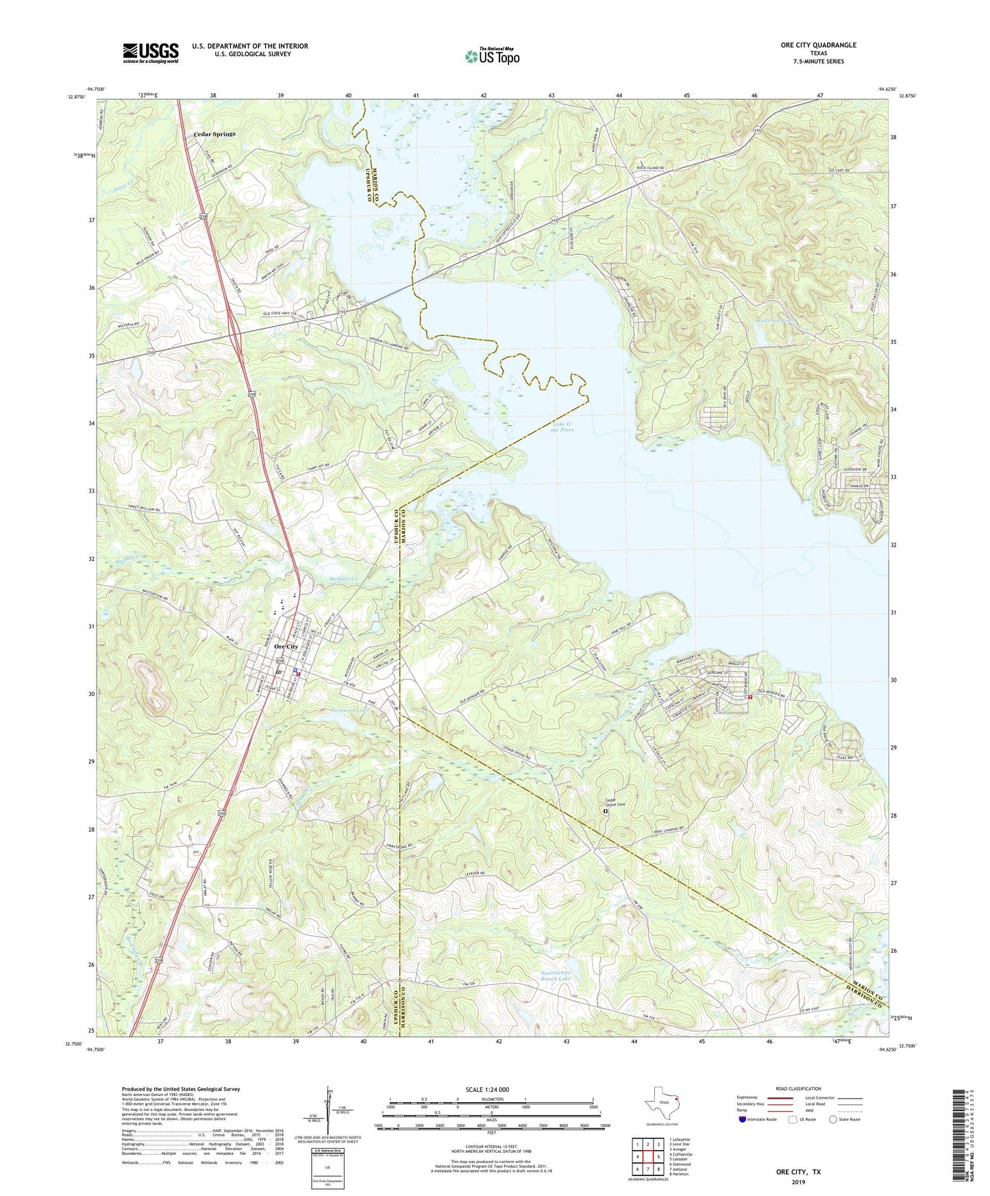
2019 topographic map quadrangle Ore City in the state of Texas. Scale: 1:24000. Based on the newly updated USGS 7.5' US Topo map series, this map is in the following counties: Marion, Upshur, Harrison. The map contains contour data, water features, and other items you are used to seeing on USGS maps, but also has updated roads and other features. This is the next generation of topographic maps. Printed on high-quality waterproof paper with UV fade-resistant inks.
Quads adjacent to this one:
West: Coffeeville
Northwest: Lafayette
North: Lone Star
Northeast: Avinger
East: Lassater
Southeast: Harleton
South: Ashland
Southwest: Glenwood
Contains the following named places: Baker Creek, Cedar Grove Cemetery, Cedar Grove Church, Cedar Springs, City of Ore City, County Line Church, County Park Campgrounds, Duncan Junior High School, Ferguson Lake, Ferguson Lake Dam, Hall Airport, Lone Star Steel Lake Dam, Meddlin Creek, Mims Chapel, Mims Chapel Lookout Tower, Oak Valley Park, Ore City, Ore City City Office, Ore City Police Department, Ore City Post Office, Ore City Volunteer Fire Department, Pine Hill Picnic Ground, Piney Grove Church, Pops Landing Campground, Railroad Pond, Rock Island, Sandy Creek, Satterwhite Ranch Lake, Satterwhite Ranch Lake Dam, South Shore Volunteer Fire Department, Sunview Church, Warners Landing Campgrounds, ZIP Code: 75683