MyTopo
Lafayette Texas US Topo Map
Couldn't load pickup availability
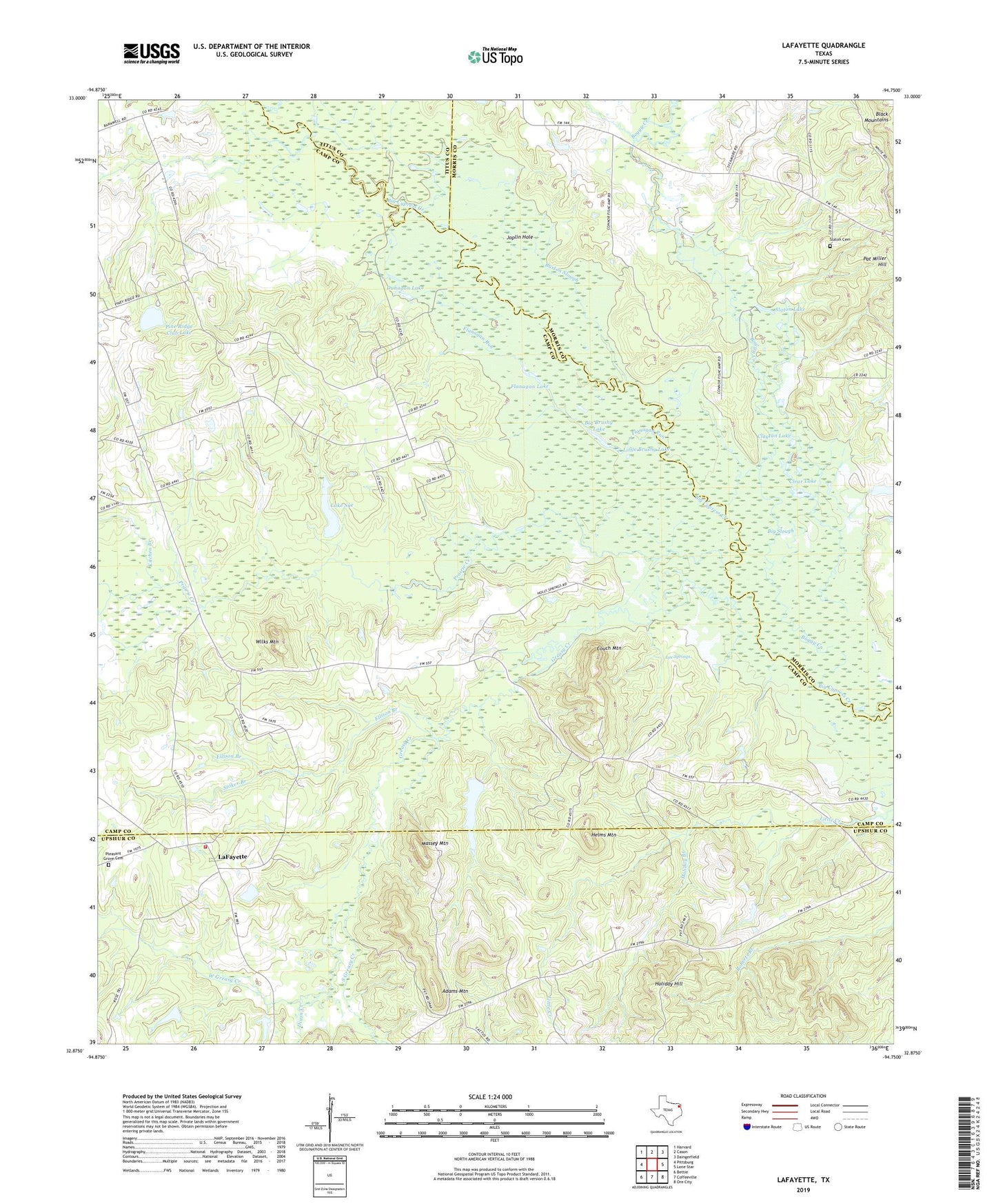
2022 topographic map quadrangle Lafayette in the state of Texas. Scale: 1:24000. Based on the newly updated USGS 7.5' US Topo map series, this map is in the following counties: Camp, Upshur, Morris, Titus. The map contains contour data, water features, and other items you are used to seeing on USGS maps, but also has updated roads and other features. This is the next generation of topographic maps. Printed on high-quality waterproof paper with UV fade-resistant inks.
Quads adjacent to this one:
West: Pittsburg
Northwest: Harvard
North: Cason
Northeast: Daingerfield
East: Lone Star
Southeast: Ore City
South: Coffeeville
Southwest: Bettie
This map covers the same area as the classic USGS quad with code o32094h7.
Contains the following named places: Adams Mountain, Antioch Church, Big Brushy Lake, Big Slough, Boggy Creek, Burton Slough, Center Point, Clayton Lake, Clear Lake, Couch Mountain, County Line, Dixon Creek, Dunagan Lake, Ellison Branch, Flanagan Lake, Flanagan Run, Greasy Creek, Helms Mountain, Holiday Branch, Holiday Hill, Holly Springs, Joplin Hole, Kitchen Branch, LaFayette, Lafayette Volunteer Fire Department, Lake Sue, Lake Sue Dam, Lee Springs, Little Brushy Lake, Massey Mountain, Mount Rose Church, Pat Miller Hill, Pine Ridge Club Dam, Pine Ridge Club Lake, Pleasant Grove Cemetery, Prairie Creek, Rafe Lake, Slaton Cemetery, Slaton Lake, South Greasy Creek, Stoker Branch, Swauano Creek, West Greasy Creek, Wilks Mountain