MyTopo
Lone Star Texas US Topo Map
Couldn't load pickup availability
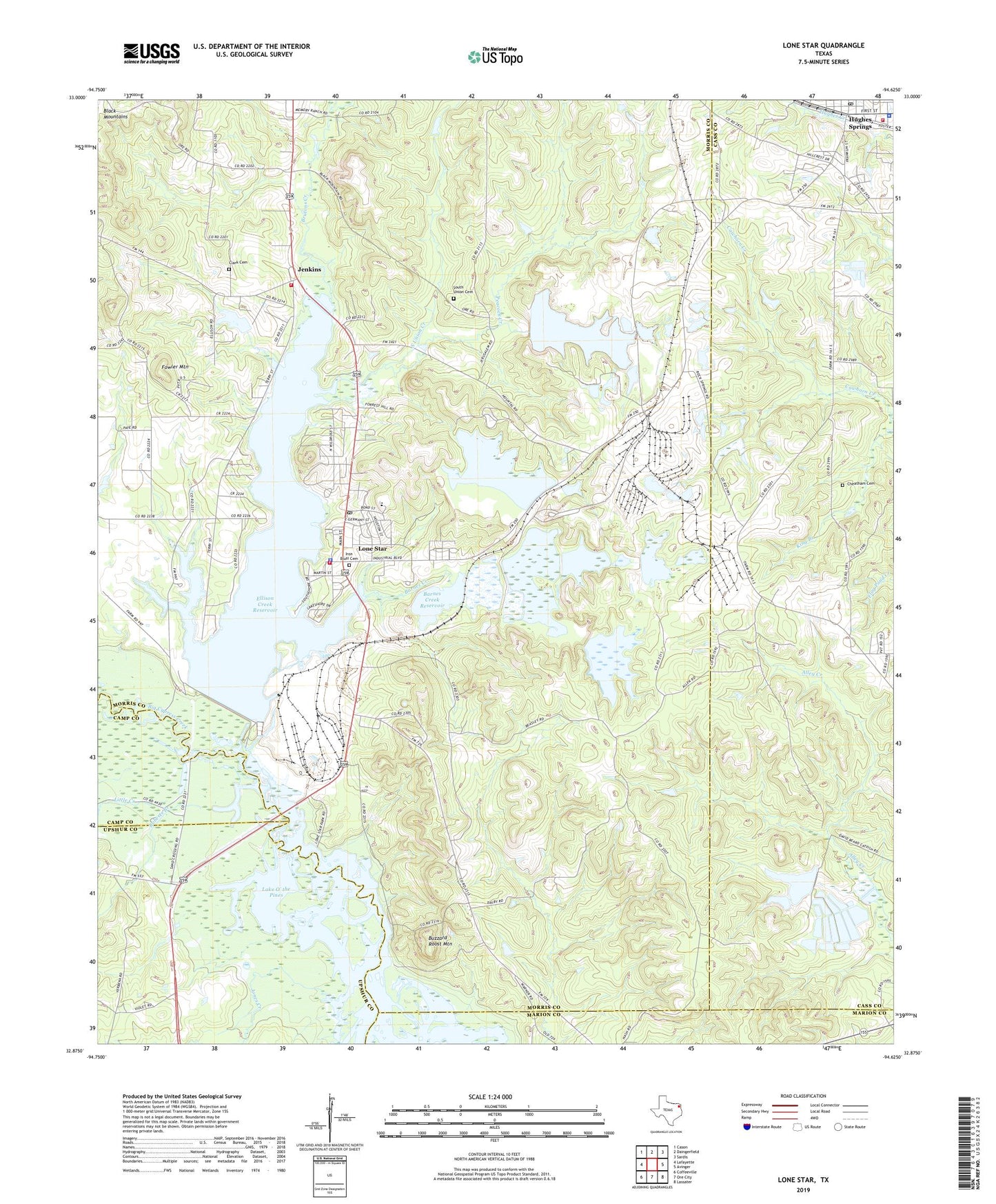
2022 topographic map quadrangle Lone Star in the state of Texas. Scale: 1:24000. Based on the newly updated USGS 7.5' US Topo map series, this map is in the following counties: Morris, Cass, Upshur, Marion, Camp. The map contains contour data, water features, and other items you are used to seeing on USGS maps, but also has updated roads and other features. This is the next generation of topographic maps. Printed on high-quality waterproof paper with UV fade-resistant inks.
Quads adjacent to this one:
West: Lafayette
Northwest: Cason
North: Daingerfield
Northeast: Sardis
East: Avinger
Southeast: Lassater
South: Ore City
Southwest: Coffeeville
This map covers the same area as the classic USGS quad with code o32094h6.
Contains the following named places: Barnes Creek, Barnes Creek Reservoir, Black Mountain Mine, Black Mountains, Bond, Brutons Creek, Buzzard Roost Mountain, Cheatham Cemetery, City of Hughes Springs, City of Lone Star, Clark Cemetery, Ellison Creek Dam, Ellison Creek Reservoir, Fowler Mountain, Gramfield Church, Harris Chapel, Hospital in the Pines, Hughes Springs, Hughes Springs City Hall, Hughes Springs Fire Station, Hughes Springs Police Department, Hughes Springs Post Office, Hughes Springs Volunteer Ambulance Service, Iron Bluff Cemetery, Jenkins, Jenkins Volunteer Fire Department, Jones Creek, Laman, Little Creek, Livity Church, Lone Star, Lone Star City Hall, Lone Star Park, Lone Star Police Department, Lone Star Post Office, Lone Star Steel Company Airport, Lone Star Volunteer Fire Department, Mount Pilgrim Church, New Jerusalem Church, Peacock Creek, Roberts Branch, South Union Cemetery, South Union Creek, Upper Barnes Creek Dam, ZIP Code: 75668