MyTopo
Paloma Texas US Topo Map
Couldn't load pickup availability
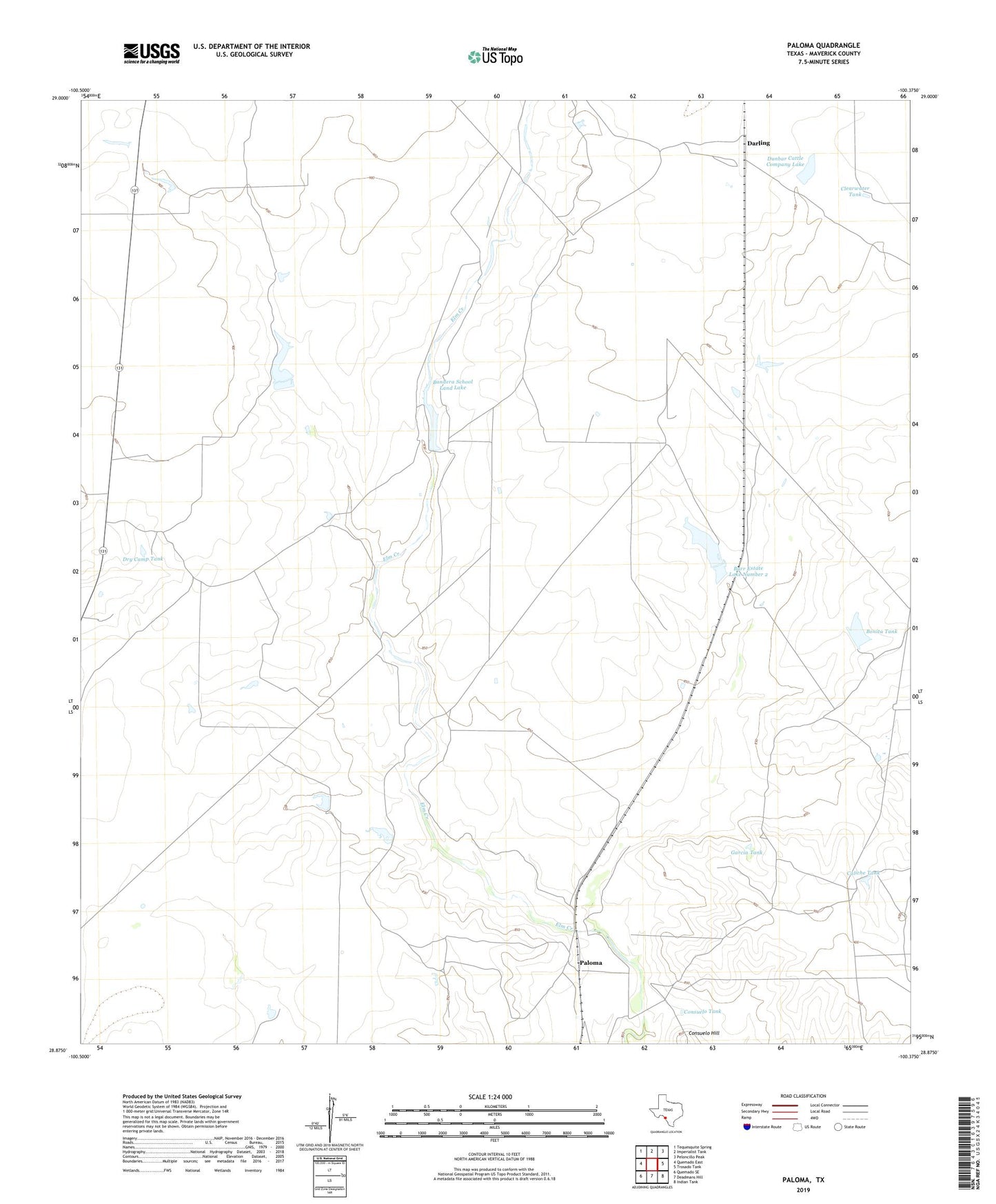
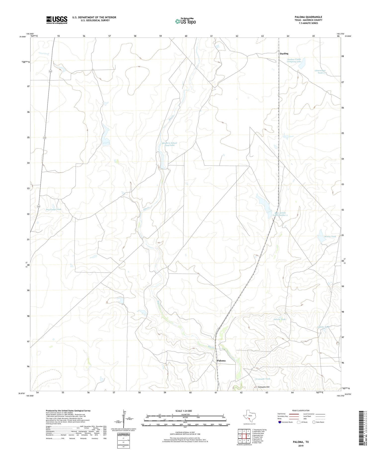
2019 topographic map quadrangle Paloma in the state of Texas. Scale: 1:24000. Based on the newly updated USGS 7.5' US Topo map series, this map is in the following counties: Maverick. The map contains contour data, water features, and other items you are used to seeing on USGS maps, but also has updated roads and other features. This is the next generation of topographic maps. Printed on high-quality waterproof paper with UV fade-resistant inks.
Quads adjacent to this one:
West: Quemado East
Northwest: Tequesquite Spring
North: Imperialist Tank
Northeast: Peloncillo Peak
East: Trosado Tank
Southeast: Indian Tank
South: Deadmans Hill
Southwest: Quemado SE
Contains the following named places: Bandera School Land Lake, Bandera School Land Lake Dam, Bonita Tank, Bonita Tank Dam, Burr Estate Lake Number 2, Burr Estate Lake Number 2 Dam, Caliche Tank, Clearwater Tank, Consuelo Tank, Darling, Dry Camp Tank, Dunbar Cattle Company Lake, Dunbar Cattle Company Lake Dam, Garcia Tank, Mangum Lake Number 1, Mangum Lake Number 1 Dam, Paloma, Rusaias Hole