MyTopo
Imperialist Tank Texas US Topo Map
Couldn't load pickup availability
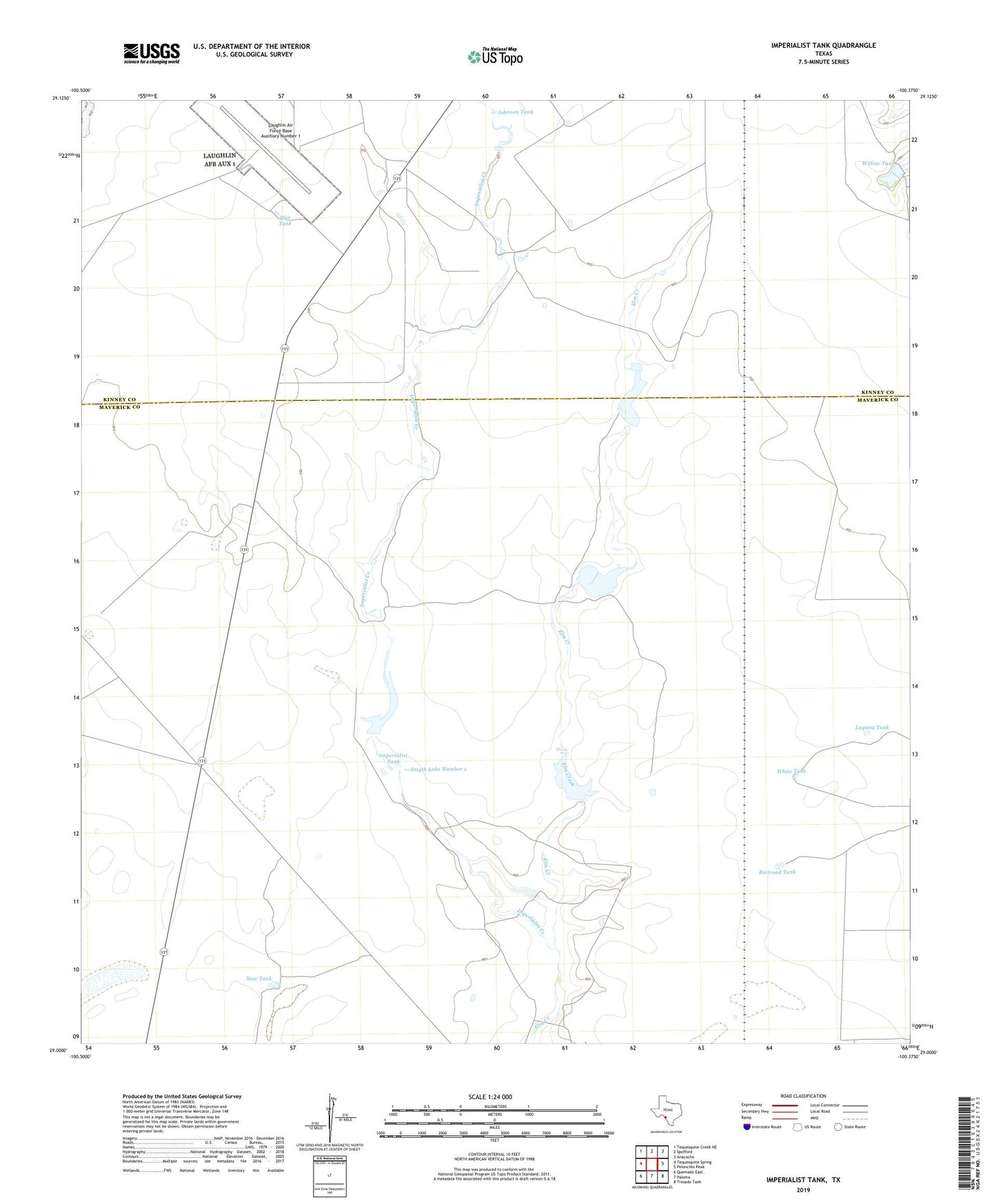
2022 topographic map quadrangle Imperialist Tank in the state of Texas. Scale: 1:24000. Based on the newly updated USGS 7.5' US Topo map series, this map is in the following counties: Maverick, Kinney. The map contains contour data, water features, and other items you are used to seeing on USGS maps, but also has updated roads and other features. This is the next generation of topographic maps. Printed on high-quality waterproof paper with UV fade-resistant inks.
Quads adjacent to this one:
West: Tequesquite Spring
Northwest: Tequesquite Creek NE
North: Spofford
Northeast: Anacacho
East: Peloncillo Peak
Southeast: Trosado Tank
South: Paloma
Southwest: Quemado East
This map covers the same area as the classic USGS quad with code o29100a4.
Contains the following named places: Burr Estate Lake Number 1, Burr Estate Lake Number 1 Dam, County Line Tank, Flat Tank, Imperialist Creek, Imperialist Tank, Johnson Tank, Laguna Tank, Laughlin Air Force Base Auxiliary Number 1, New Tank, Railroad Tank, Smyth Lake Number 1, Smyth Lake Number 1 Dam, Smyth Lake Number 2, Smyth Lake Number 2 Dam, White Tank, Willow Tank, Xmas Tank