MyTopo
Paluxy Texas US Topo Map
Couldn't load pickup availability
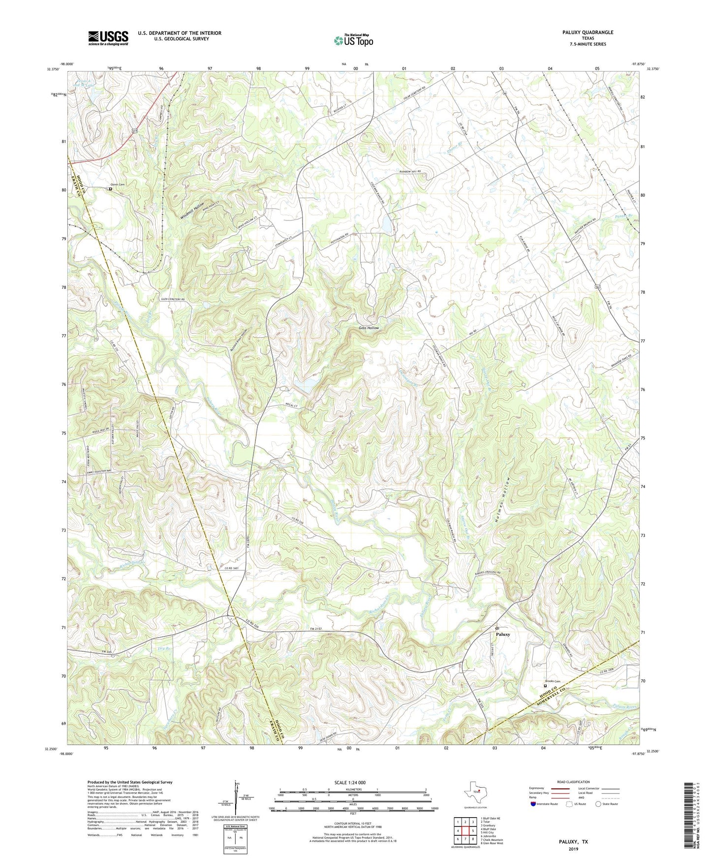
2019 topographic map quadrangle Paluxy in the state of Texas. Scale: 1:24000. Based on the newly updated USGS 7.5' US Topo map series, this map is in the following counties: Hood, Erath, Somervell. The map contains contour data, water features, and other items you are used to seeing on USGS maps, but also has updated roads and other features. This is the next generation of topographic maps. Printed on high-quality waterproof paper with UV fade-resistant inks.
Quads adjacent to this one:
West: Bluff Dale
Northwest: Bluff Dale NE
North: Tolar
Northeast: Granbury
East: Hill City
Southeast: Glen Rose West
South: Chalk Mountain
Southwest: Johnsville
Contains the following named places: Brooks Cemetery, Buzzard Roost Hollow, Camp Paluxy, Dry Branch, Dunnagan Branch, Elm Grove Church, Glenn Cemetery, Goss Hollow, Holmes Hollow, Paluxy, Paluxy Post Office, Panter Branch Hall, Pony Creek, Richardson Creek, Rock Church, Starve Out Branch, Sycamore Creek, Texas A and M Lake, Texas A and M Lake Dam, Windmill Hollow, ZIP Code: 76476